File:Renumbered National Highways map of India (Schematic) hilight 19 44.png
Jump to navigation
Jump to search
Size of this preview: 549 × 600 pixels. Other resolutions: 220 × 240 pixels | 439 × 480 pixels | 937 × 1,024 pixels.
Original file (937 × 1,024 pixels, file size: 580 KB, MIME type: image/png)
Captions
Captions
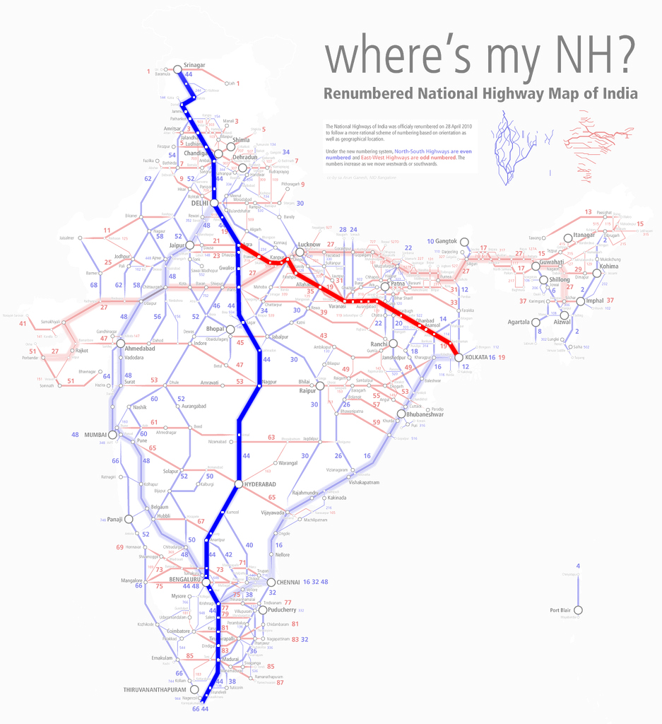
National Highways map of India, highlighting Highway 19 & 44 (former Grand Trunk Road)
Summary[edit]
_hilight_19_44.png&action=edit§ion=1)
| Description |
English: National Highways map of India, highlighting Highway 19 & 44 (approximate route of the former Grand Trunk Road) |
| Date | |
| Source |
.jpg) |
| Author | Arun Ganesh |
Licensing[edit]
_hilight_19_44.png&action=edit§ion=2)
This file is licensed under the Creative Commons Attribution-Share Alike 2.0 Generic license.
- You are free:
- to share – to copy, distribute and transmit the work
- to remix – to adapt the work
- Under the following conditions:
- attribution – You must give appropriate credit, provide a link to the license, and indicate if changes were made. You may do so in any reasonable manner, but not in any way that suggests the licensor endorses you or your use.
- share alike – If you remix, transform, or build upon the material, you must distribute your contributions under the same or compatible license as the original.
File history
Click on a date/time to view the file as it appeared at that time.
| Date/Time | Thumbnail | Dimensions | User | Comment | |
|---|---|---|---|---|---|
| current | 13:41, 27 December 2020 | | 937 × 1,024 (580 KB) | XyKyWyKy (talk | contribs) | Uploaded a work by Arun Ganesh from https://commons.wikimedia.org/w/index.php?title=File:Renumbered_National_Highways_map_of_India_(Schematic).jpg with UploadWizard |
You cannot overwrite this file.
File usage on Commons
The following 2 pages use this file:
File usage on other wikis
The following other wikis use this file:
- Usage on pt.wikipedia.org
- Usage on te.wikipedia.org
_hilight_19_44.png&oldid=541349280)