File:River Bann near the Corbet - geograph.org.uk - 171976.jpg
Jump to navigation
Jump to search
No higher resolution available.
River_Bann_near_the_Corbet_-_geograph.org.uk_-_171976.jpg (640 × 426 pixels, file size: 154 KB, MIME type: image/jpeg)
Captions
Captions
Add a one-line explanation of what this file represents
Summary[edit]
| Description |
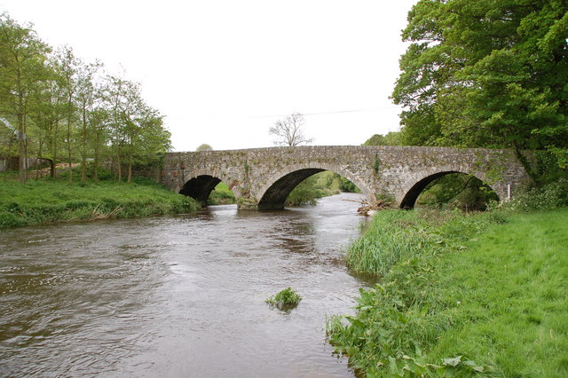
English: River Bann near the Corbet. The River Bann rises in the Mournes near Spelga Dam but does not reach any appreciable width until beyond Gilford. About 4 miles east of Banbridge it is normally little more than a stream. The photograph shows the river (swollen by heavy rain) as it passes under a fine stone bridge at the Drone Hill Road, Tullyconnaught near the Corbet. From slightly further downstream to Gilford it once provided power for a number of linen mills. |
| Date | |
| Source | From geograph.org.uk |
| Author | Aubrey Dale |
| Object location | | View this and other nearby images on: OpenStreetMap |
|---|
_heading:90.00&language=en)
Licensing[edit]

|
This image was taken from the Geograph project collection. See this photograph's page on the Geograph website for the photographer's contact details. The copyright on this image is owned by Aubrey Dale and is licensed for reuse under the Creative Commons Attribution-ShareAlike 2.0 license.
|
This file is licensed under the Creative Commons Attribution-Share Alike 2.0 Generic license.
Attribution: Aubrey Dale
- You are free:
- to share – to copy, distribute and transmit the work
- to remix – to adapt the work
- Under the following conditions:
- attribution – You must give appropriate credit, provide a link to the license, and indicate if changes were made. You may do so in any reasonable manner, but not in any way that suggests the licensor endorses you or your use.
- share alike – If you remix, transform, or build upon the material, you must distribute your contributions under the same or compatible license as the original.
File history
Click on a date/time to view the file as it appeared at that time.
| Date/Time | Thumbnail | Dimensions | User | Comment | |
|---|---|---|---|---|---|
| current | 15:01, 31 January 2010 | | 640 × 426 (154 KB) | GeographBot (talk | contribs) | == {{int:filedesc}} == {{Information |description={{en|1=River Bann near the Corbet. The River Bann rises in the Mournes near Spelga Dam but does not reach any appreciable width until beyond Gilford. About 4 miles east of Banbridge it is normally little |
You cannot overwrite this file.
File usage on Commons
There are no pages that use this file.