File:River Wey Map 2.png
Jump to navigation
Jump to search
Size of this preview: 597 × 600 pixels. Other resolutions: 239 × 240 pixels | 478 × 480 pixels | 644 × 647 pixels.
Original file (644 × 647 pixels, file size: 85 KB, MIME type: image/png)
Captions
Captions
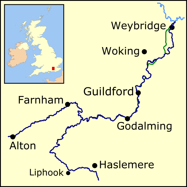
Map of the River Wey, a tributary of the River Thames in south east England.
Summary[edit]
| Description |
English: Map of the River Wey (dark blue), showing both the North and South branches. Part of the River Thames is shown in light blue. Canal sections of the Wey and Godalming Navigations are shown in green. |
| Date | |
| Source | Own work |
| Author | Mertbiol |
Licensing[edit]
I, the copyright holder of this work, hereby publish it under the following license:
| This file is made available under the Creative Commons CC0 1.0 Universal Public Domain Dedication. | |
| The person who associated a work with this deed has dedicated the work to the public domain by waiving all of their rights to the work worldwide under copyright law, including all related and neighboring rights, to the extent allowed by law. You can copy, modify, distribute and perform the work, even for commercial purposes, all without asking permission.
|
File history
Click on a date/time to view the file as it appeared at that time.
| Date/Time | Thumbnail | Dimensions | User | Comment | |
|---|---|---|---|---|---|
| current | 22:07, 8 January 2022 | | 644 × 647 (85 KB) | Mertbiol (talk | contribs) | improve colour of main map |
| 11:06, 6 September 2020 |  | 675 × 678 (90 KB) | Mertbiol (talk | contribs) | Background colour changed; Haslemere switched for Hindhead; text sizes tweaked. | |
| 11:43, 5 September 2020 |  | 676 × 664 (92 KB) | Mertbiol (talk | contribs) | Uploaded own work with UploadWizard |
You cannot overwrite this file.
File usage on Commons
There are no pages that use this file.
File usage on other wikis
The following other wikis use this file:
- Usage on de.wikipedia.org
- Usage on en.wikipedia.org
- Usage on fi.wikipedia.org
- Usage on pl.wikipedia.org