File:Riverfront Park Near Old Fort Erie, Fort Erie, Ontario (29358763683).jpg

Original file (4,000 × 3,000 pixels, file size: 4.93 MB, MIME type: image/jpeg)
Captions
Captions
Summary[edit]
.jpg&action=edit§ion=1)
| Description |
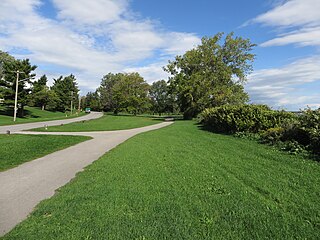
Fort Erie is a town on the Niagara River in the Niagara Region, Ontario, Canada. It is directly across the river from Buffalo, New York and is the site of Old Fort Erie which played a prominent role in the War of 1812. Fort Erie is one of Niagara's fastest growing communities, and has experienced a high level of residential and commercial development in the past few years. Garrison Road (Niagara Regional Road 3) is the town's commercial corridor, stretching east to west through Fort Erie. Fort Erie is also home to other commercial core areas (Bridgeburg, Ridgeway, Stevensville and Crystal Beach) as a result of the 1970 amalgamation of Bertie Township and the village of Crystal Beach with Fort Erie. Crystal Beach Amusement Park occupied waterfront land at Crystal Beach, Ontario from 1888 until the park's closure in 1989. The beach is part of Fort Erie. Fort Erie is generally flat, but there are low sand hills, varying in height from 2 to 15 metres (6.6 to 49.2 ft), along the shore of Lake Erie, and a limestone ridge extends from Point Abino to near Miller's Creek, giving Ridgeway its name. The soil is shallow, with a clay subsoil. The town's beaches on Lake Erie, most notably Erie Beach, Crystal Beach and Bay Beach, are considered the best in the area and draw many weekend visitors from the Toronto and Buffalo, New York areas. While summers are enjoyable, winters can occasionally be fierce, with many snowstorms, whiteouts and winds coming off Lake Erie. <a href="https://en.wikipedia.org/wiki/Fort_Erie,_Ontario" rel="noreferrer nofollow">en.wikipedia.org/wiki/Fort_Erie,_Ontario</a> <a href="https://en.wikipedia.org/wiki/Wikipedia:Text_of_Creative_Commons_Attribution-ShareAlike_3.0_Unported_License" rel="noreferrer nofollow">en.wikipedia.org/wiki/Wikipedia:Text_of_Creative_Commons_...</a> |
| Date | |
| Source | Riverfront Park Near Old Fort Erie, Fort Erie, Ontario |
| Author | Ken Lund from Reno, Nevada, USA |
| Camera location | | View this and other nearby images on: OpenStreetMap |
|---|
.jpg¶ms=042.893136_N_-078.922320_E_globe:Earth_type:camera_source:Flickr_&language=en)
Licensing[edit]
.jpg&action=edit§ion=2)
- You are free:
- to share – to copy, distribute and transmit the work
- to remix – to adapt the work
- Under the following conditions:
- attribution – You must give appropriate credit, provide a link to the license, and indicate if changes were made. You may do so in any reasonable manner, but not in any way that suggests the licensor endorses you or your use.
- share alike – If you remix, transform, or build upon the material, you must distribute your contributions under the same or compatible license as the original.
| This image was originally posted to Flickr by Ken Lund at https://flickr.com/photos/75683070@N00/29358763683. It was reviewed on 10 March 2022 by FlickreviewR 2 and was confirmed to be licensed under the terms of the cc-by-sa-2.0. |
File history
Click on a date/time to view the file as it appeared at that time.
| Date/Time | Thumbnail | Dimensions | User | Comment | |
|---|---|---|---|---|---|
| current | 19:19, 10 March 2022 | | 4,000 × 3,000 (4.93 MB) | Mindmatrix (talk | contribs) | Transferred from Flickr via #flickr2commons |
You cannot overwrite this file.
File usage on Commons
There are no pages that use this file.
.jpg&oldid=668121180)