File:Robert Mueller Municipal Airport FAA Diagram.png
Jump to navigation
Jump to search
Size of this preview: 403 × 599 pixels. Other resolutions: 161 × 240 pixels | 323 × 480 pixels | 517 × 768 pixels | 689 × 1,024 pixels | 1,665 × 2,474 pixels.
Original file (1,665 × 2,474 pixels, file size: 5.82 MB, MIME type: image/png)
Captions
Captions
Add a one-line explanation of what this file represents
Summary[edit]
| Description |
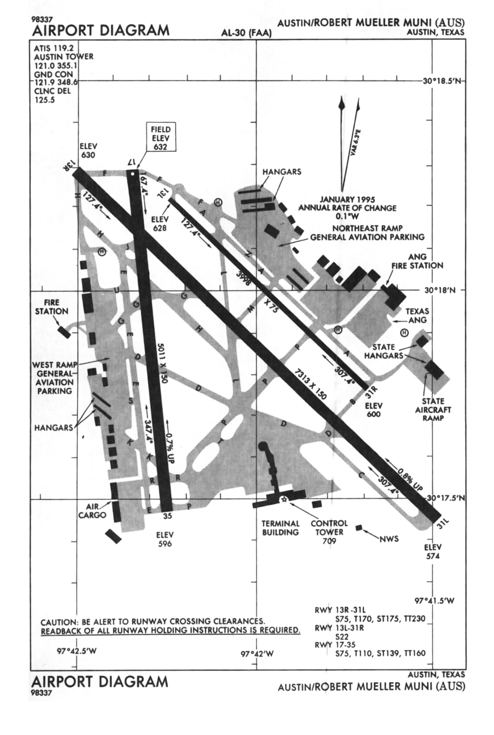
English: FAA airport diagram |
| Date | |
| Source | FAA AJV-A Aeronautical Information Services, Airport Mapping Team |
| Author | FAA |
Licensing[edit]
This work is in the public domain in the United States because it is a work prepared by an officer or employee of the United States Government as part of that person’s official duties under the terms of Title 17, Chapter 1, Section 105 of the US Code.
Note: This only applies to original works of the Federal Government and not to the work of any individual U.S. state, territory, commonwealth, county, municipality, or any other subdivision. This template also does not apply to postage stamp designs published by the United States Postal Service since 1978. (See § 313.6(C)(1) of Compendium of U.S. Copyright Office Practices). It also does not apply to certain US coins; see The US Mint Terms of Use.
|
 | |
| This file has been identified as being free of known restrictions under copyright law, including all related and neighboring rights. | ||
File history
Click on a date/time to view the file as it appeared at that time.
| Date/Time | Thumbnail | Dimensions | User | Comment | |
|---|---|---|---|---|---|
| current | 19:20, 16 September 2021 | | 1,665 × 2,474 (5.82 MB) | Demoacct (talk | contribs) | FAA-supplied 1998 Dylux proof shows more clear taxiways, etc. |
| 02:31, 17 November 2016 |  | 1,190 × 1,773 (690 KB) | Skylerspaeth (talk | contribs) | User created page with UploadWizard |
You cannot overwrite this file.
File usage on Commons
The following 2 pages use this file:
File usage on other wikis
The following other wikis use this file:
- Usage on en.wikipedia.org
- Usage on uk.wikipedia.org