File:Roter Kamm crater x2.jpg
Jump to navigation
Jump to search
Size of this preview: 800 × 426 pixels. Other resolutions: 320 × 170 pixels | 640 × 341 pixels | 1,122 × 597 pixels.
Original file (1,122 × 597 pixels, file size: 129 KB, MIME type: image/jpeg)
Captions
Captions
Add a one-line explanation of what this file represents
Summary[edit]
| Camera location | | View this and other nearby images on: OpenStreetMap |
|---|
| Description |
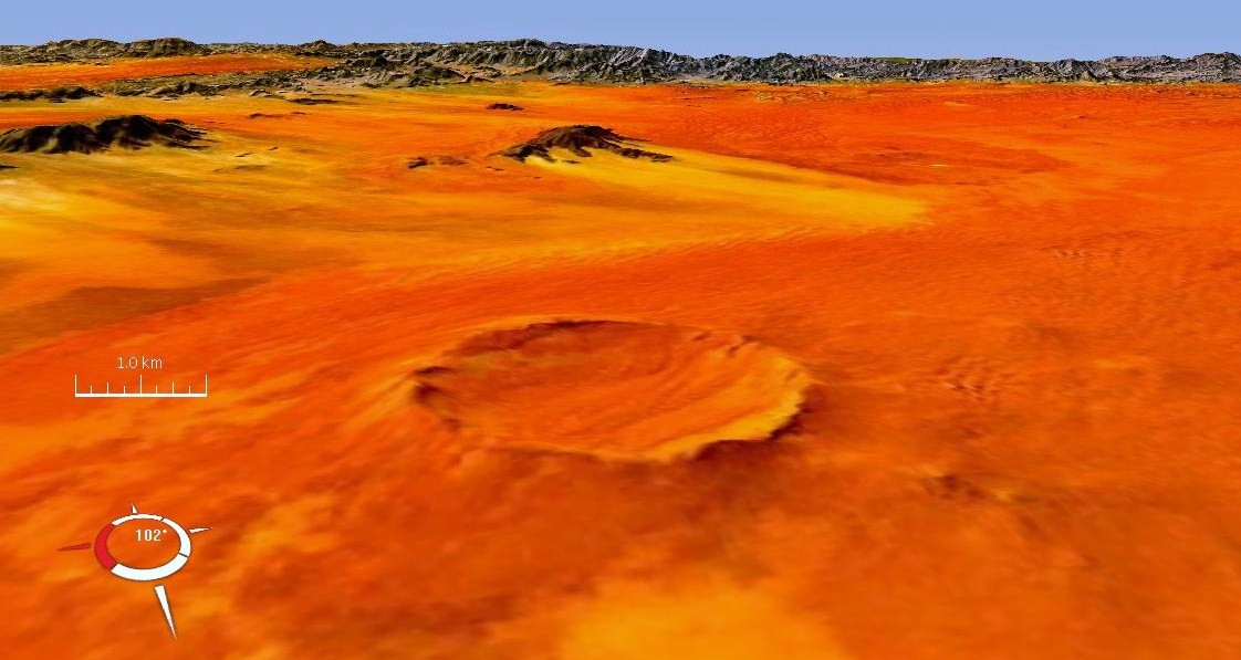
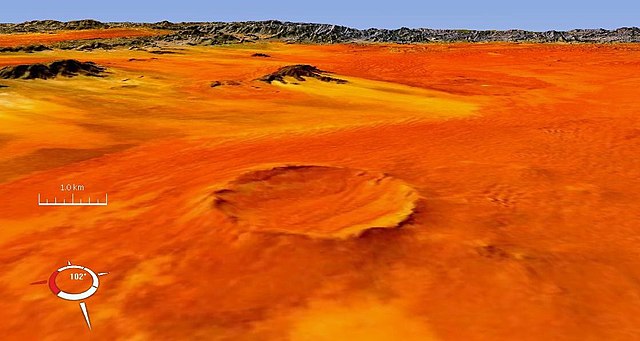
Afrikaans: Skuinsaansig op die Roter Kamm-trefkrater in die Diamantspergebied van die Karas-provinsie van suid-Namibië. Drapering van 'n digitale hoogtemodel met x2 vertikale vergroting
Deutsch: Der Rote Kamm, ein Einschlagkrater mittlerer Größe, in der Namib-Wüste im Süden Namibias innerhalb des Diamantensperrgebiets, in der Region Karas.
English: Oblique landsat image of Roter Kamm meteorite impact crater in the Karas province of southern Namibia, draped over digital elevation model with x2 vertical exaggeration |
| Date | circa 2007-10 |
| Source | Screen capture from NASA World Wind |
| Author | NASA |
| Other versions |
Top view:  |
Licensing[edit]
| This image is in the public domain because it is a screenshot from NASA’s globe software World Wind using a public domain layer, such as Blue Marble, MODIS, Landsat, SRTM, USGS or GLOBE.
|
 |
File history
Click on a date/time to view the file as it appeared at that time.
| Date/Time | Thumbnail | Dimensions | User | Comment | |
|---|---|---|---|---|---|
| current | 13:22, 10 October 2007 | | 1,122 × 597 (129 KB) | Zamphuor~commonswiki (talk | contribs) | Oblique landsat image of Roter Kamm meteorite impact crater in Namibia, draped over digital elevation model with x2 vertical exaggeration. Screen capture from NASA World Wind. |
You cannot overwrite this file.
File usage on Commons
The following page uses this file:
File usage on other wikis
The following other wikis use this file:
- Usage on cs.wikipedia.org
- Usage on de.wikipedia.org
- Usage on en.wikipedia.org
- Usage on it.wikipedia.org
- Usage on mk.wikipedia.org
- Usage on ro.wikipedia.org
- Usage on su.wikipedia.org
- Usage on te.wikipedia.org
- Usage on uk.wikipedia.org