File:Ruin Island with Cape Russell in Background.jpg
Jump to navigation
Jump to search
No higher resolution available.
Ruin_Island_with_Cape_Russell_in_Background.jpg (700 × 520 pixels, file size: 278 KB, MIME type: image/jpeg)
Captions
Captions
Add a one-line explanation of what this file represents
Summary[edit]
| Description |
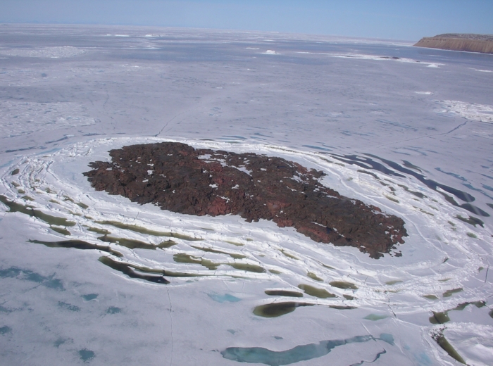
English: Ruin Island off the Northeast coast of Greenland
coordinates 78.867894,-69.189861 |
| Date | |
| Source | http://www.ilapweb.info/files/Ruin%20Island%20with%20Cape%20Russell%20in%20Background.jpg |
| Author | Inglefield Land Archaeological Project / John Darwent |
| Camera location | | View this and other nearby images on: OpenStreetMap |
|---|
Licensing[edit]
The copyright holder gave me express permission to publish this photo under the Creative Commons Attribution-ShareAlike 3.0 Unported License
This file is licensed under the Creative Commons Attribution-Share Alike 3.0 United States license.
- You are free:
- to share – to copy, distribute and transmit the work
- to remix – to adapt the work
- Under the following conditions:
- attribution – You must give appropriate credit, provide a link to the license, and indicate if changes were made. You may do so in any reasonable manner, but not in any way that suggests the licensor endorses you or your use.
- share alike – If you remix, transform, or build upon the material, you must distribute your contributions under the same or compatible license as the original.

File history
Click on a date/time to view the file as it appeared at that time.
| Date/Time | Thumbnail | Dimensions | User | Comment | |
|---|---|---|---|---|---|
| current | 22:28, 29 September 2013 | | 700 × 520 (278 KB) | WikiPeterD (talk | contribs) | User created page with UploadWizard |
You cannot overwrite this file.
File usage on Commons
There are no pages that use this file.
File usage on other wikis
The following other wikis use this file:
- Usage on en.wikipedia.org
- Usage on sv.wikipedia.org
- Usage on www.wikidata.org