File:Ryhill Halt railway station (site), Yorkshire (geograph 3471653).jpg
Jump to navigation
Jump to search
Size of this preview: 800 × 600 pixels. Other resolutions: 320 × 240 pixels | 640 × 480 pixels | 1,024 × 768 pixels.
Original file (1,024 × 768 pixels, file size: 157 KB, MIME type: image/jpeg)
Captions
Captions
Add a one-line explanation of what this file represents
Summary[edit]
,_Yorkshire_(geograph_3471653).jpg&action=edit§ion=1)
| Description |
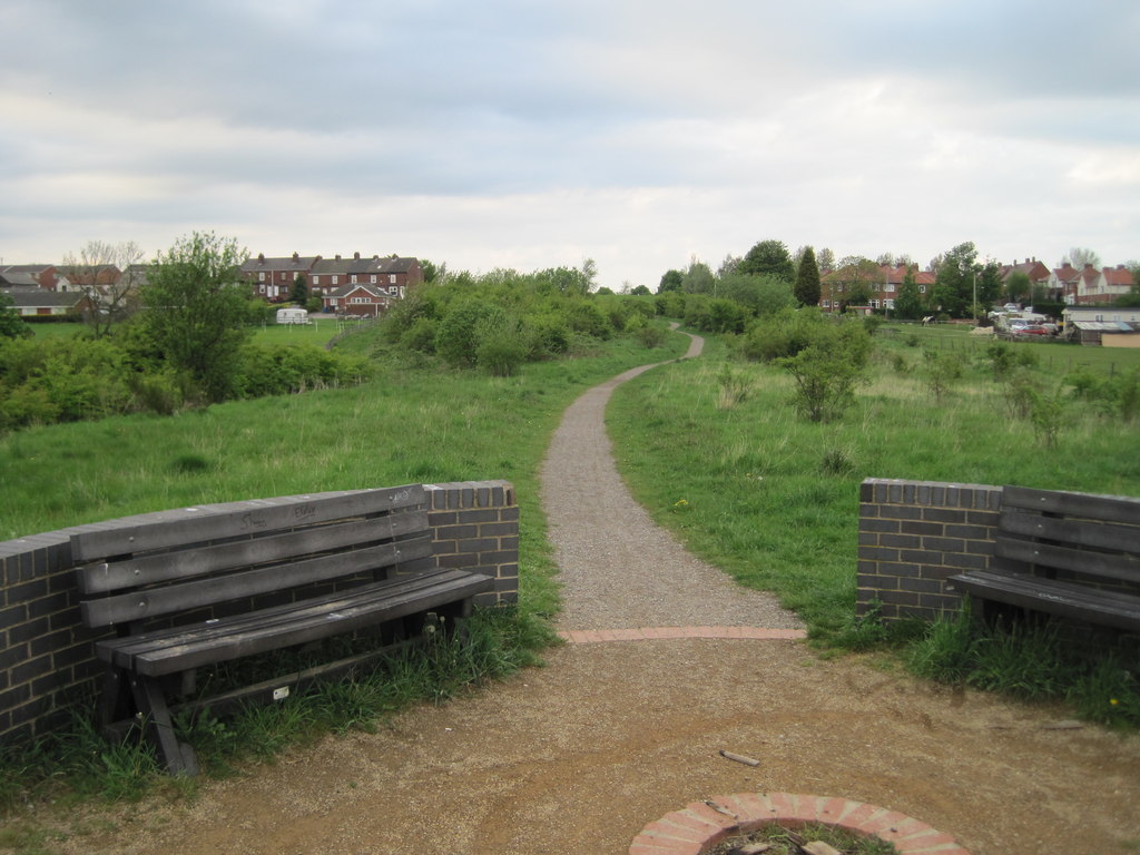
English: Ryhill Halt railway station (site), Yorkshire Opened in 1912 by the Lancashire & Yorkshire Railway on their Dearne Valley Railway from Wakefield Kirkgate to Edlington (south west of Doncaster), this station closed in 1951. The halts on this line were apparently made of old sleepers with an old railway carriage for shelter, so not surprisingly nothing remains. In addition, the cutting here appears to have been filled in and landscaped, so the photographer is probably standing many feet above the site of the station. View north west towards Wakefield. |
| Date | |
| Source | From geograph.org.uk |
| Author | Nigel Thompson |
| Permission (Reusing this file) |
Creative Commons Attribution Share-alike license 2.0 |
| Attribution (required by the license) | Nigel Thompson / Ryhill Halt railway station (site), Yorkshire / |
| Camera location | | View this and other nearby images on: OpenStreetMap |
|---|
,_Yorkshire_(geograph_3471653).jpg¶ms=053.616156_N_-001.412987_E_globe:Earth_type:camera_source:geograph-osgb36(SE38931345)_heading:22.00&language=en)
| Object location | | View this and other nearby images on: OpenStreetMap |
|---|
,_Yorkshire_(geograph_3471653).jpg¶ms=053.617050_N_-001.412370_E_globe:Earth_class:object_type:object_source:geograph-osgb36(SE38971355)_heading:22.00&language=en)
Licensing[edit]
,_Yorkshire_(geograph_3471653).jpg&action=edit§ion=2)

|
This image was taken from the Geograph project collection. See this photograph's page on the Geograph website for the photographer's contact details. The copyright on this image is owned by Nigel Thompson and is licensed for reuse under the Creative Commons Attribution-ShareAlike 2.0 license.
|
This file is licensed under the Creative Commons Attribution-Share Alike 2.0 Generic license.
Attribution: Nigel Thompson
- You are free:
- to share – to copy, distribute and transmit the work
- to remix – to adapt the work
- Under the following conditions:
- attribution – You must give appropriate credit, provide a link to the license, and indicate if changes were made. You may do so in any reasonable manner, but not in any way that suggests the licensor endorses you or your use.
- share alike – If you remix, transform, or build upon the material, you must distribute your contributions under the same or compatible license as the original.
File history
Click on a date/time to view the file as it appeared at that time.
| Date/Time | Thumbnail | Dimensions | User | Comment | |
|---|---|---|---|---|---|
| current | 17:25, 17 May 2018 | | 1,024 × 768 (157 KB) | Schlosser67 (talk | contribs) | Transferred from geograph.co.uk using [https://tools.wmflabs.org/geograph2commons/ geograph2commons] |
You cannot overwrite this file.
File usage on Commons
The following page uses this file:
File usage on other wikis
The following other wikis use this file:
- Usage on en.wikipedia.org
- Usage on www.wikidata.org
,_Yorkshire_(geograph_3471653).jpg&oldid=546014963)