File:Saltney Ferry Road and Mold Junction railway bridge - geograph.org.uk - 1459289.jpg
Jump to navigation
Jump to search
No higher resolution available.
Saltney_Ferry_Road_and_Mold_Junction_railway_bridge_-_geograph.org.uk_-_1459289.jpg (640 × 480 pixels, file size: 148 KB, MIME type: image/jpeg)
Captions
Captions
Add a one-line explanation of what this file represents
Summary[edit]
| Description |
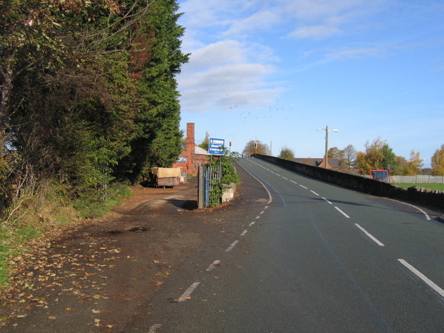
English: Saltney Ferry Road and Mold Junction railway bridge. This photo shows how Saltney Ferry Road was moved east, and taken over a bridge, when the level of rail traffic made the original level crossing, shown on the 1892 O.S. map, impractical. The old road now provides access to P.Dobbins scrap yard. There is a bench mark on the very end of the stone wall facing the camera but it is almost completely hidden by the raised pavement - see 1459305. |
| Date | |
| Source | From geograph.org.uk |
| Author | John S Turner |
| Attribution (required by the license) | John S Turner / Saltney Ferry Road and Mold Junction railway bridge / |
| Camera location | | View this and other nearby images on: OpenStreetMap |
|---|
_heading:0.00&language=en)
| Object location | | View this and other nearby images on: OpenStreetMap |
|---|
_heading:0.00&language=en)
Licensing[edit]

|
This image was taken from the Geograph project collection. See this photograph's page on the Geograph website for the photographer's contact details. The copyright on this image is owned by John S Turner and is licensed for reuse under the Creative Commons Attribution-ShareAlike 2.0 license.
|
This file is licensed under the Creative Commons Attribution-Share Alike 2.0 Generic license.
Attribution: John S Turner
- You are free:
- to share – to copy, distribute and transmit the work
- to remix – to adapt the work
- Under the following conditions:
- attribution – You must give appropriate credit, provide a link to the license, and indicate if changes were made. You may do so in any reasonable manner, but not in any way that suggests the licensor endorses you or your use.
- share alike – If you remix, transform, or build upon the material, you must distribute your contributions under the same or compatible license as the original.
File history
Click on a date/time to view the file as it appeared at that time.
| Date/Time | Thumbnail | Dimensions | User | Comment | |
|---|---|---|---|---|---|
| current | 06:12, 2 March 2011 | | 640 × 480 (148 KB) | GeographBot (talk | contribs) | == {{int:filedesc}} == {{Information |description={{en|1=Saltney Ferry Road and Mold Junction railway bridge This photo shows how Saltney Ferry Road was moved east, and taken over a bridge, when the level of rail traffic made the original level crossing, |
You cannot overwrite this file.
File usage on Commons
There are no pages that use this file.