File:Samborzec (gmina) location map.png
Original file (2,345 × 1,705 pixels, file size: 689 KB, MIME type: image/png)
Captions
Captions
Summary[edit]
_location_map.png&action=edit§ion=1)
| Description |
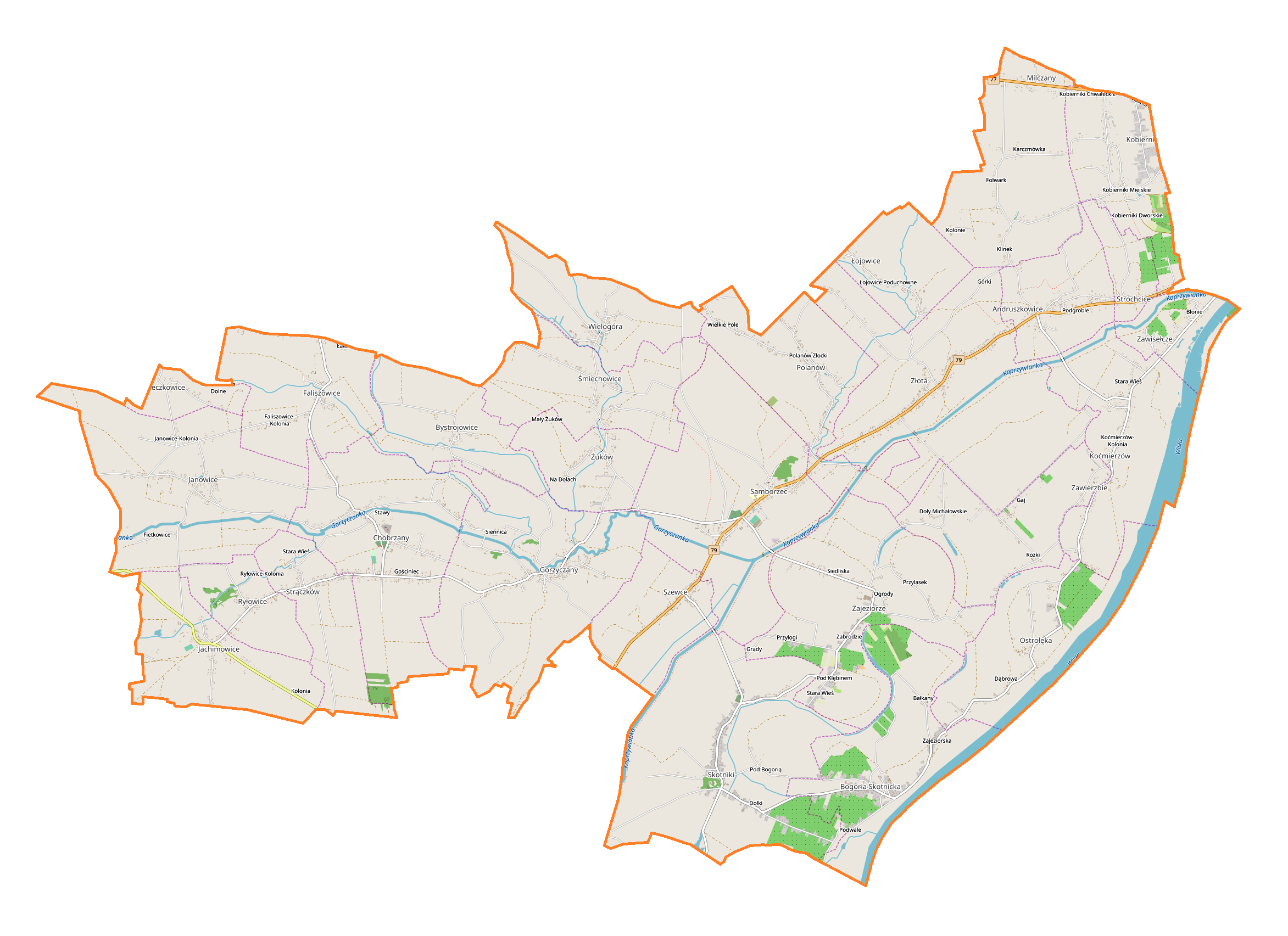
English: Location map |
| Date | |
| Source | Own work |
| Author | Smat |
| Description |
Polski: Mapa gminy Samborzec, Polska
English: Map of Samborzec (gmina), Poland |
|||||||||
| Date | ||||||||||
| Source | You may find a page on the OpenStreetMap wiki page for Samborzec (gmina) | |||||||||
| Creator |
OpenStreetMap contributors OpenStreetMap contributors |
|||||||||
| Permission (Reusing this file) |
OpenStreetMap data is available under the Open Database License (details). Map tiles are licensed under the Creative Commons Attribution-ShareAlike 2.0 license (CC-BY-SA 2.0).
This file is licensed under the Creative Commons Attribution-Share Alike 2.0 Generic license.
|
|||||||||
| Geotemporal data | ||||||||||
| Bounding box |
|
|||||||||
| Georeferencing | If inappropriate please set warp_status = skip to hide. | |||||||||
Licensing[edit]
_location_map.png&action=edit§ion=2)
| This work contains information from OpenStreetMap, which is made available under the Open Database License (ODbL).
The ODbL does not require any particular license for maps produced from ODbL data. Prior to 1 August 2020, map tiles produced by the OpenStreetMap Foundation were licensed under the CC-BY-SA-2.0 license. Maps produced by other people may be subject to other licences. |
File history
Click on a date/time to view the file as it appeared at that time.
| Date/Time | Thumbnail | Dimensions | User | Comment | |
|---|---|---|---|---|---|
| current | 12:27, 23 March 2019 | | 2,345 × 1,705 (689 KB) | Smat (talk | contribs) | User created page with UploadWizard |
You cannot overwrite this file.
File usage on Commons
There are no pages that use this file.
File usage on other wikis
The following other wikis use this file:
- Usage on pl.wikipedia.org
- Chobrzany
- Andruszkowice
- Bogoria Skotnicka
- Bystrojowice
- Gorzyczany
- Jachimowice
- Krzeczkowice
- Koćmierzów
- Milczany (województwo świętokrzyskie)
- Ryłowice
- Samborzec
- Strączków
- Strochcice
- Zawisełcze
- Faliszowice (województwo świętokrzyskie)
- Kobierniki (województwo świętokrzyskie)
- Łojowice (województwo świętokrzyskie)
- Ostrołęka (województwo świętokrzyskie)
- Polanów (województwo świętokrzyskie)
- Skotniki (województwo świętokrzyskie)
- Śmiechowice (województwo świętokrzyskie)
- Wielogóra (województwo świętokrzyskie)
- Zajeziorze (powiat sandomierski)
- Zawierzbie (województwo świętokrzyskie)
- Janowice (powiat sandomierski)
- Szewce (powiat sandomierski)
- Złota (powiat sandomierski)
- Żuków (powiat sandomierski)
- Parafia Trójcy Przenajświętszej w Samborcu
- Parafia św. Jana Chrzciciela w Skotnikach
- Parafia św. Jana Ewangelisty w Chobrzanach
- Kobierniki Miejskie
- Kolonie (gmina Samborzec)
- Kościół Trójcy Przenajświętszej w Samborcu
- Jachimowice (stacja kolejowa)
- Moduł:Mapa/dane/Samborzec (gmina)
- Usage on pl.wikibooks.org
_location_map.png&oldid=704425893)