File:Sas Hill of Buda Nature Reserve, bicycle racks, Újbuda, 2016 Budapest.jpg
Jump to navigation
Jump to search

Size of this preview: 450 × 600 pixels. Other resolutions: 180 × 240 pixels | 360 × 480 pixels | 576 × 768 pixels | 768 × 1,024 pixels | 2,448 × 3,264 pixels.
Original file (2,448 × 3,264 pixels, file size: 1.81 MB, MIME type: image/jpeg)
Captions
Captions
Add a one-line explanation of what this file represents
Summary[edit]
| Description |
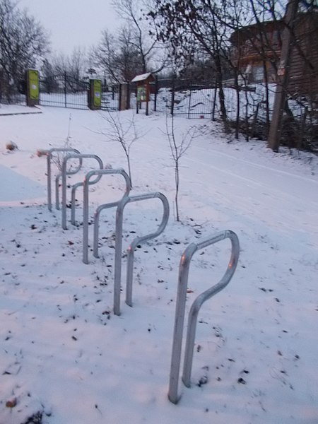
English: : Sas Hill of Buda. A horst-like, seemingly bare white dolomite block of Sas Hill is a peculiar feature amidst the built-in mass of capital. The peak of its is: 266m a.s.l. Scientific research was begun here already in the 19th century. Famous scientists like Pál Kitaibel, József Sadler or Ferenc Horustzky worked here. In the course of time just as Ottó Herman and János Balogh who described the spider fauna of the area. The botanical value of the reserve comprises the most famous representatives of the Hungarian dolomite flora /e.g. St. Stephen wild pink (Dianthus colllinus), Hungarian meadow saxifrage (Seseli leucosprmum), Buda knapweed (Centaurea sadleriana)/. There are animals so. Besides its extremely rich spider and insect fauna, the hill is also the habitat of the Pannonian lizard (Ablapharus kitaibelii). Under national protection since 1957. Guided tours. Get in: take bus no. 8 from 'Március 15 tér' and get off at the 'Korompai utca' stop, and walk about 200m upwards on Korompai utca and turn left at Tájék utca and walk to the end of its cca. 100m. "Source" : Budapest's Protected Natural Heritage. Edited by Municipality of Budapest in 1996. Supported by Phare (EU project), ISBN 9630471523. - Tájék Street, Sashegy, Újbuda, Budapest. Magyar: : A Duna-Ipoly Nemzeti Park része a Budai Sas-hegy Természetvédelmi Területet. Itt kerül bemutatásra a Budai hegyekre jellemző dolomit sziklagyep. A területről nagyszerű kilátás nyílik a Gellért hegyre és a Budai várra. Védett növényzete: Dunai szegfű, magyar gurgolya, budai imola. Védett állata: pannon gyík. - Budapest, XI. kerület, Sashegy, Tájék utca, 2
|
||||
| Date | |||||
| Source | Own work | ||||
| Author | Globetrotter19 |
Licensing[edit]
I, the copyright holder of this work, hereby publish it under the following license:
This file is licensed under the Creative Commons Attribution-Share Alike 3.0 Unported license.
- You are free:
- to share – to copy, distribute and transmit the work
- to remix – to adapt the work
- Under the following conditions:
- attribution – You must give appropriate credit, provide a link to the license, and indicate if changes were made. You may do so in any reasonable manner, but not in any way that suggests the licensor endorses you or your use.
- share alike – If you remix, transform, or build upon the material, you must distribute your contributions under the same or compatible license as the original.
File history
Click on a date/time to view the file as it appeared at that time.
| Date/Time | Thumbnail | Dimensions | User | Comment | |
|---|---|---|---|---|---|
| current | 11:27, 18 July 2016 | | 2,448 × 3,264 (1.81 MB) | Globetrotter19 (talk | contribs) | User created page with UploadWizard |
You cannot overwrite this file.
File usage on Commons
The following page uses this file:
Metadata
This file contains additional information such as Exif metadata which may have been added by the digital camera, scanner, or software program used to create or digitize it. If the file has been modified from its original state, some details such as the timestamp may not fully reflect those of the original file. The timestamp is only as accurate as the clock in the camera, and it may be completely wrong.
| Camera manufacturer | NIKON | ||||
|---|---|---|---|---|---|
| Camera model | COOLPIX L29 | ||||
| Exposure time | 1/2 sec (0.5) | ||||
| F-number | f/3.2 | ||||
| ISO speed rating | 400 | ||||
| Date and time of data generation | 16:19, 4 January 2015 | ||||
| Lens focal length | 4.6 mm | ||||
| Short title |
| ||||
| Image title |
| ||||
| Orientation | Normal | ||||
| Horizontal resolution | 300 dpi | ||||
| Vertical resolution | 300 dpi | ||||
| Software used | Microsoft Windows Photo Viewer 6.1.7600.16385 | ||||
| File change date and time | 14:20, 6 January 2016 | ||||
| Y and C positioning | Co-sited | ||||
| Exposure Program | Normal program | ||||
| Exif version | 2.3 | ||||
| Date and time of digitizing | 16:19, 4 January 2015 | ||||
| Meaning of each component |
| ||||
| Image compression mode | 2 | ||||
| APEX exposure bias | 0 | ||||
| Maximum land aperture | 3.4 APEX (f/3.25) | ||||
| Metering mode | Pattern | ||||
| Light source | Unknown | ||||
| Flash | Flash did not fire, compulsory flash suppression | ||||
| Supported Flashpix version | 1 | ||||
| Color space | sRGB | ||||
| File source | Digital still camera | ||||
| Scene type | A directly photographed image | ||||
| Custom image processing | Normal process | ||||
| Exposure mode | Auto exposure | ||||
| White balance | Auto white balance | ||||
| Digital zoom ratio | 0 | ||||
| Focal length in 35 mm film | 26 mm | ||||
| Scene capture type | Landscape | ||||
| Scene control | High gain up | ||||
| Contrast | Normal | ||||
| Saturation | Normal | ||||
| Sharpness | Normal | ||||
| Subject distance range | Unknown |