File:September 17 1947 surface analysis.png
Jump to navigation
Jump to search
Size of this preview: 711 × 599 pixels. Other resolutions: 285 × 240 pixels | 569 × 480 pixels | 758 × 639 pixels.
Original file (758 × 639 pixels, file size: 834 KB, MIME type: image/png)
Captions
Captions
Add a one-line explanation of what this file represents
Summary[edit]
| Description |
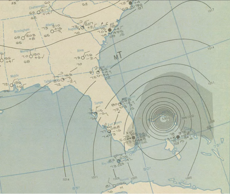
English: Surface weather map showing the September 17, 1947, hurricane approaching South Florida |
|||
| Date | ||||
| Source | NOAA Central Library | |||
| Author |
|
Licensing[edit]
This image is in the public domain because it contains materials that originally came from the U.S. National Oceanic and Atmospheric Administration, taken or made as part of an employee's official duties.
|
File history
Click on a date/time to view the file as it appeared at that time.
| Date/Time | Thumbnail | Dimensions | User | Comment | |
|---|---|---|---|---|---|
| current | 20:28, 8 July 2012 | | 758 × 639 (834 KB) | CapeVerdeWave~commonswiki (talk | contribs) |
You cannot overwrite this file.
File usage on Commons
There are no pages that use this file.
File usage on other wikis
The following other wikis use this file:
- Usage on en.wikipedia.org