File:Siberian Khanate map Russian.svg
Jump to navigation
Jump to search

Size of this PNG preview of this SVG file: 488 × 600 pixels. Other resolutions: 195 × 240 pixels | 390 × 480 pixels | 625 × 768 pixels | 833 × 1,024 pixels | 1,666 × 2,048 pixels | 3,050 × 3,750 pixels.
Original file (SVG file, nominally 3,050 × 3,750 pixels, file size: 113 KB)
Captions
Captions
Add a one-line explanation of what this file represents
Summary[edit]
| Description |
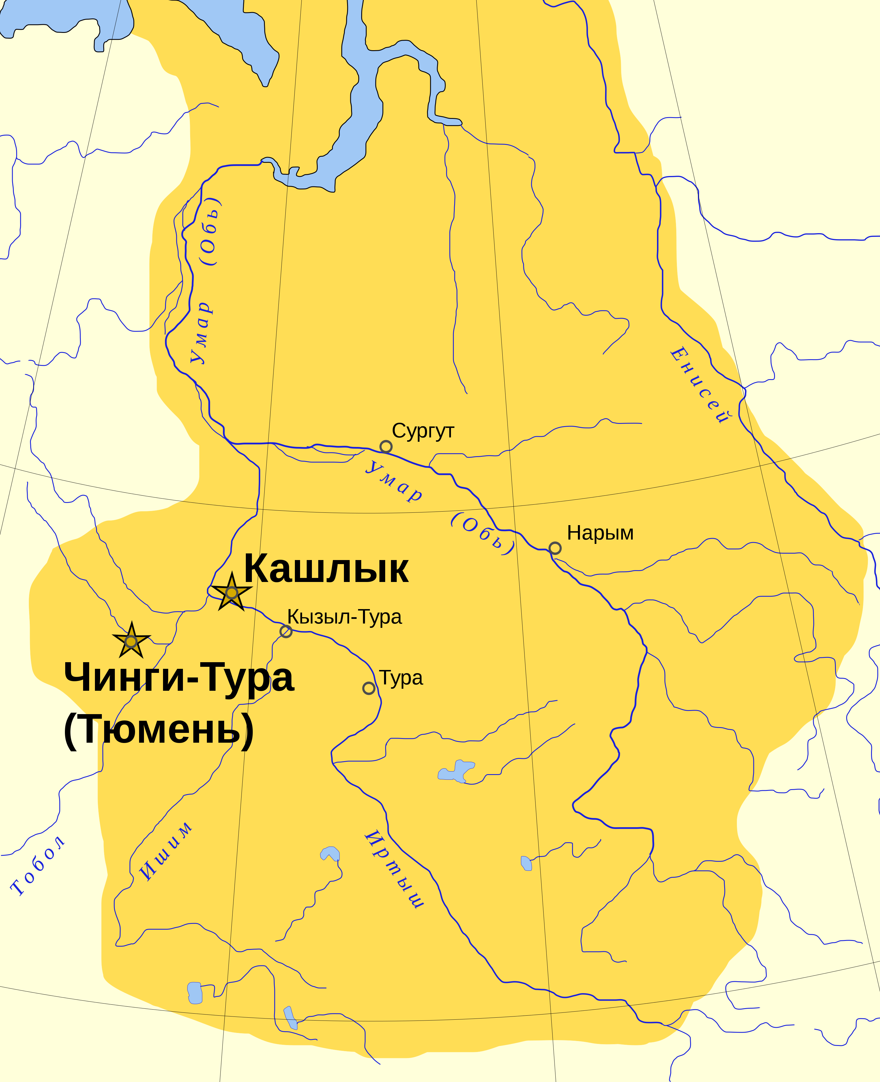
Русский: Граница ханство не доходила до Севернего Ледовитого океана и Енисея.
English: The Khanate was probably smaller than the yellow area. Yenisei river and beach of Arctic Ocean weren't part of the khanate. |
| Date | |
| Source | производная работа |
| Author | Untifler |
| Other versions |
[]
|


Licensing[edit]
| This work has been released into the public domain by its author, Untifler. This applies worldwide. In some countries this may not be legally possible; if so: |
File history
Click on a date/time to view the file as it appeared at that time.
| Date/Time | Thumbnail | Dimensions | User | Comment | |
|---|---|---|---|---|---|
| current | 16:56, 11 December 2015 | | 3,050 × 3,750 (113 KB) | Павло Сарт (talk | contribs) | Исправлена опечатка. |
| 14:32, 11 December 2015 |  | 3,050 × 3,750 (113 KB) | Павло Сарт (talk | contribs) | User created page with UploadWizard |
You cannot overwrite this file.
File usage on Commons
The following 6 pages use this file:
File usage on other wikis
The following other wikis use this file:
- Usage on uk.wikipedia.org