File:Soo Locks and International Bridge USACE 2010-04-19.jpg
Jump to navigation
Jump to search

Size of this preview: 800 × 532 pixels. Other resolutions: 320 × 213 pixels | 640 × 426 pixels | 1,024 × 681 pixels | 1,280 × 852 pixels | 2,560 × 1,703 pixels | 6,144 × 4,088 pixels.
Original file (6,144 × 4,088 pixels, file size: 9.29 MB, MIME type: image/jpeg)
Captions
Captions
Add a one-line explanation of what this file represents
| Description |
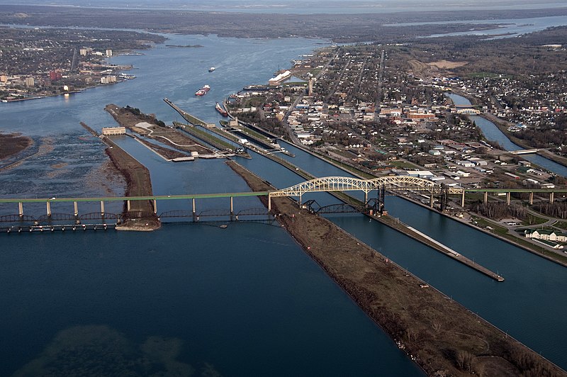
English: The Soo Locks and the Sault Ste. Marie International Bridge over the St. Marys River between Sault Ste. Marie, Ontario and Sault Ste. Marie, Michigan. View is looking east. |
|||
| Date | ||||
| Source | US Army Corps of Engineers Digital Visual Library (DVL) [1]. Photo ID: 100419-A-9999M-849 | |||
| Author | US Army Corps of Engineers, Richard McDonald | |||
| Permission (Reusing this file) |
|
| Object location | | View this and other nearby images on: OpenStreetMap |
|---|
| Annotations | This image is annotated: View the annotations at Commons |
File history
Click on a date/time to view the file as it appeared at that time.
| Date/Time | Thumbnail | Dimensions | User | Comment | |
|---|---|---|---|---|---|
| current | 21:49, 3 September 2011 | | 6,144 × 4,088 (9.29 MB) | Life of Riley (talk | contribs) | {{Information |Description={{en|The Soo Locks and the Sault Ste. Marie International Bridge over the St. Marys River between Sault Ste. Marie, Ontario and Sault Ste. Marie, Michigan. View is look |
You cannot overwrite this file.
File usage on Commons
There are no pages that use this file.
File usage on other wikis
The following other wikis use this file:
- Usage on en.wikipedia.org
- Usage on nl.wikipedia.org