File:South African Geology - Schwarz - 1912 Fig 39, Groot River.png
Jump to navigation
Jump to search
Size of this preview: 800 × 584 pixels. Other resolutions: 320 × 234 pixels | 640 × 467 pixels | 1,005 × 734 pixels.
Original file (1,005 × 734 pixels, file size: 1,023 KB, MIME type: image/png)
Captions
Captions
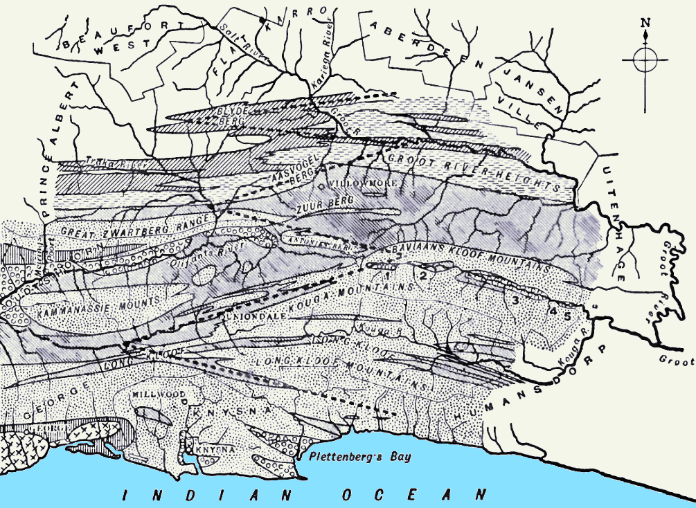
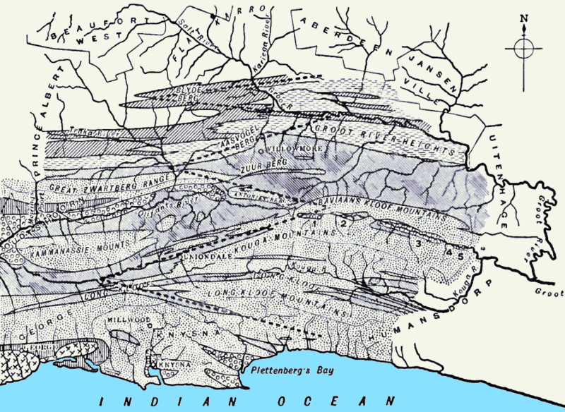
Eastward courses of the Kouga and Groot Rivers in the southern Cape, South Africa
Summary[edit]
| Description |
English: Figure from South African Geology - Schwarz - 1912 (Page 139) Fig. 39.—Detailed Map of the Folds where they splay out seawards to the east of the granite bosses of George. 1, 2, 3, 4, 5 are the fold-basins or fault-pits of Baviaan's Kloof. |
| Date | |
| Source |
 |
| Author | Schwarz, Ernest Hubert Lewis, 1873-1928 |
| Other versions |
 |
Licensing[edit]
|
This work is in the public domain in its country of origin and other countries and areas where the copyright term is the author's life plus 70 years or fewer. This work is in the public domain in the United States because it was published (or registered with the U.S. Copyright Office) before January 1, 1929. | |
| This file has been identified as being free of known restrictions under copyright law, including all related and neighboring rights. | |
File history
Click on a date/time to view the file as it appeared at that time.
| Date/Time | Thumbnail | Dimensions | User | Comment | |
|---|---|---|---|---|---|
| current | 21:36, 26 September 2023 | | 1,005 × 734 (1,023 KB) | JMK (talk | contribs) | Uploaded own work with UploadWizard |
You cannot overwrite this file.
File usage on Commons
The following 2 pages use this file:
File usage on other wikis
The following other wikis use this file:
- Usage on en.wikipedia.org
- Usage on eo.wikipedia.org
- Usage on www.wikidata.org