File:South america fr.svg
Jump to navigation
Jump to search

Size of this PNG preview of this SVG file: 452 × 600 pixels. Other resolutions: 181 × 240 pixels | 362 × 480 pixels | 579 × 768 pixels | 772 × 1,024 pixels | 1,544 × 2,048 pixels | 505 × 670 pixels.
Original file (SVG file, nominally 505 × 670 pixels, file size: 565 KB)
Captions
Captions
Add a one-line explanation of what this file represents

Summary[edit]
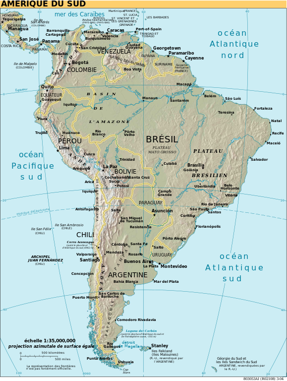
| Description | Amérique du Sud |
| Date | |
| Source | South america fr.svg |
| Author | |
| Other versions | Derivative works of this file: Dakar Rally 2012 map-fr.svg |
| SVG development | This map was created with Adobe Illustrator. |
Licensing[edit]
This image is in the public domain because it contains materials that originally came from the United States Central Intelligence Agency's World Factbook.
|
 |
| I, the copyright holder of this work, release this work into the public domain. This applies worldwide. In some countries this may not be legally possible; if so: I grant anyone the right to use this work for any purpose, without any conditions, unless such conditions are required by law. |
File history
Click on a date/time to view the file as it appeared at that time.
| Date/Time | Thumbnail | Dimensions | User | Comment | |
|---|---|---|---|---|---|
| current | 18:35, 12 May 2018 | | 505 × 670 (565 KB) | JoKalliauer (talk | contribs) | xlink:href="data:image/jpeg;base64, |
| 09:16, 25 January 2006 |  | 504 × 670 (872 KB) | Moyogo (talk | contribs) | Iles Sandwich et Géorgies du Sud | |
| 08:12, 25 January 2006 |  | 504 × 670 (872 KB) | Moyogo (talk | contribs) | haut-plateaux de Guyane → plateau des Guyanes haut-plateaux brésilien → plateua brésilien testing new fonts | |
| 19:28, 24 January 2006 |  | 504 × 670 (871 KB) | Moyogo (talk | contribs) | == Description == Amérique du Sud<br /> Origine : CIA World Factbook converti en SVG et traduit Category:SVG maps Category:South America {{PD-USGov-CIA-WF}} |
You cannot overwrite this file.
File usage on Commons
The following 5 pages use this file:
File usage on other wikis
The following other wikis use this file:
- Usage on azb.wikipedia.org
- Usage on fr.wikipedia.org
- Usage on pl.wiktionary.org
- Indeks:Niemiecki - Kraje Ameryki
- Indeks:Francuski - Kraje Ameryki
- Indeks:Hiszpański - Kraje Ameryki
- Indeks:Serbski - Kraje Ameryki
- Indeks:Chorwacki - Kraje Ameryki
- Indeks:Portugalski - Kraje Ameryki
- Indeks:Niderlandzki - Kraje Ameryki
- Indeks:Nowogrecki - Kraje Ameryki
- Indeks:Bułgarski - Kraje Ameryki
- Indeks:Włoski - Kraje Ameryki
- Indeks:Arabski - Kraje Ameryki
- Indeks:Baskijski - Kraje Ameryki
- Usage on ru.wikipedia.org