File:South georgia Islands map-He.svg
Jump to navigation
Jump to search

Size of this PNG preview of this SVG file: 800 × 485 pixels. Other resolutions: 320 × 194 pixels | 640 × 388 pixels | 1,024 × 620 pixels | 1,280 × 776 pixels | 2,560 × 1,551 pixels | 954 × 578 pixels.
Original file (SVG file, nominally 954 × 578 pixels, file size: 140 KB)
Captions
Captions
Add a one-line explanation of what this file represents
Summary[edit]
| Description |
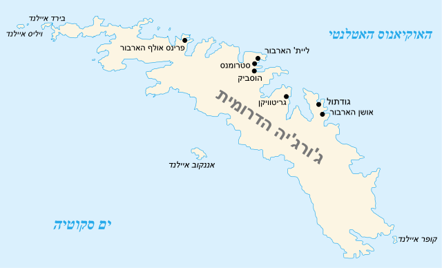
English: Map of South Georgia Island Français : Carte de la Géorgie du Sud |
||
| Date | |||
| Source | |||
| Author |
|
||
| Other versions |
[]
|
||
| SVG development | This diagram was created with Inkscape, or with something else.
|


Licensing[edit]
I, the copyright holder of this work, hereby publish it under the following licenses:
| This file is licensed under the Creative Commons Attribution-Share Alike 3.0 Unported license. | ||
| ||
| This licensing tag was added to this file as part of the GFDL licensing update. |

|
Permission is granted to copy, distribute and/or modify this document under the terms of the GNU Free Documentation License, Version 1.2 or any later version published by the Free Software Foundation; with no Invariant Sections, no Front-Cover Texts, and no Back-Cover Texts. A copy of the license is included in the section entitled GNU Free Documentation License. |
You may select the license of your choice.
Original upload log[edit]
This image is a derivative work of the following images:
- File:South_georgia_Islands_map-en.svg licensed with Cc-by-sa-3.0-migrated, GFDL
- 2007-05-31T07:05:46Z Historicair 954x578 (66946 Bytes)
- 2007-05-30T22:10:59Z Historicair 954x578 (67045 Bytes) {{Information |Description={{en}}Map of South Georgia Island {{fr}}Carte de la Géorgie du Sud |Source=Lyubomir Ivanov + Own work |Date=31/05/2007 |Author=~~~~ |Permission={{GFDL}} |other_versions=In french: [[:Image:South ge
Uploaded with derivativeFX
File history
Click on a date/time to view the file as it appeared at that time.
| Date/Time | Thumbnail | Dimensions | User | Comment | |
|---|---|---|---|---|---|
| current | 19:15, 14 September 2011 | | 954 × 578 (140 KB) | Itzuvit (talk | contribs) | Font size |
| 18:58, 14 September 2011 |  | 954 × 578 (135 KB) | Itzuvit (talk | contribs) | {{Information |Description={{en|Map of South Georgia Island}} {{fr|Carte de la Géorgie du Sud}} |Source=*File:South_georgia_Islands_map-en.svg |Date=2011-09-14 18:57 (UTC) |Author=*File:South_georgia_Islands_map-en.svg: [[User:Historicair|his |
You cannot overwrite this file.
File usage on Commons
The following 15 pages use this file:
- File:South georgia Islands map-CA.svg
- File:South georgia Islands map-HE.svg
- File:South georgia Islands map-He.svg
- File:South georgia Islands map-ar.svg
- File:South georgia Islands map-be.svg
- File:South georgia Islands map-ca.svg
- File:South georgia Islands map-de.svg
- File:South georgia Islands map-en.svg
- File:South georgia Islands map-es.svg
- File:South georgia Islands map-fr-locations.PNG
- File:South georgia Islands map-lv.svg
- File:South georgia Islands map-mk.svg
- File:South georgia Islands map-no.svg
- File:South georgia Islands map-ru.svg
- Template:Other versions/South Georgia Islands
File usage on other wikis
The following other wikis use this file:
- Usage on he.wikipedia.org