File:Southern Madeira.jpg
Jump to navigation
Jump to search

Size of this preview: 800 × 513 pixels. Other resolutions: 320 × 205 pixels | 640 × 411 pixels | 1,024 × 657 pixels | 1,280 × 821 pixels | 2,560 × 1,643 pixels | 3,411 × 2,189 pixels.
Original file (3,411 × 2,189 pixels, file size: 1.11 MB, MIME type: image/jpeg)
Captions
Captions
Add a one-line explanation of what this file represents
Summary[edit]
| Description |
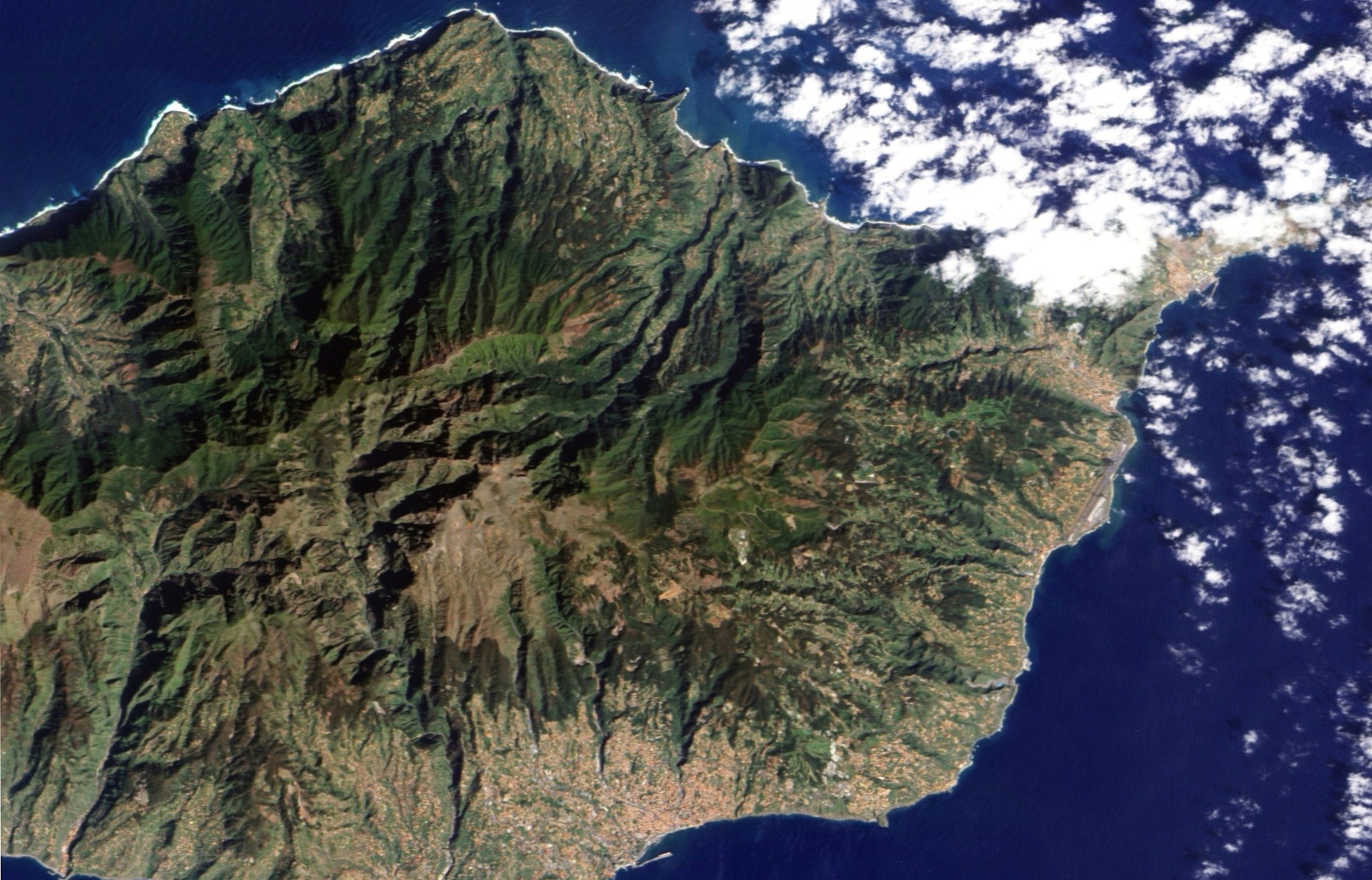
English: Two topographic features characterize this part of the Madeiran landscape: steep mountains and deep ravines. Both landforms are evident in this image. Deep ravines define the path water routinely takes off the island. In shadow in the morning sunlight, the ravines are like dark wrinkles radiating from the centre of the island in this image. The cities, the colour of terracotta roof tiles, are built mostly around the ravines in this region with two notable exceptions. The small town of Ribeira Brava sits at the mouth of a large ravine that extends from the heart of the island. The second exception is Funchal, the island’s capital. Three rivers run from the mountains into the city. The deep ravines that bring two of the rivers into the city are evident in the image. The rivers are lined with some of the city’s primary roads, and they come together in a “v” near the harbour. |
| Date | |
| Source | NASA Earth Observatory |
| Author | Jesse Allen |
| Other versions |
|

This image was taken by the Advanced Land Imager on NASA’s EO-1 satellite. EO-1 ALI data provided by the NASA EO-1 team.
Licensing[edit]
| This file is in the public domain in the United States because it was solely created by NASA. NASA copyright policy states that "NASA material is not protected by copyright unless noted". (See Template:PD-USGov, NASA copyright policy page or JPL Image Use Policy.) | ||
 |
Warnings:
|
| Annotations | This image is annotated: View the annotations at Commons |
File history
Click on a date/time to view the file as it appeared at that time.
| Date/Time | Thumbnail | Dimensions | User | Comment | |
|---|---|---|---|---|---|
| current | 00:14, 17 August 2012 | | 3,411 × 2,189 (1.11 MB) | DarwIn (talk | contribs) | Reverted to version as of 14:02, 24 February 2010 |
| 00:13, 17 August 2012 |  | 3,999 × 2,999 (4.56 MB) | DarwIn (talk | contribs) | Higher res from same source | |
| 14:02, 24 February 2010 |  | 3,411 × 2,189 (1.11 MB) | Originalwana (talk | contribs) | {{Information |Description={{en|1=Two topographic features characterize this part of the Madeiran landscape: steep mountains and deep ravines. Both landforms are evident in this image. Deep ravines define the path water routinely takes of |
You cannot overwrite this file.
File usage on Commons
The following page uses this file:
File usage on other wikis
The following other wikis use this file: