File:St. Bridget's Kirk.jpg
Jump to navigation
Jump to search
No higher resolution available.
St._Bridget's_Kirk.jpg (640 × 480 pixels, file size: 95 KB, MIME type: image/jpeg)
Captions
Captions
Add a one-line explanation of what this file represents
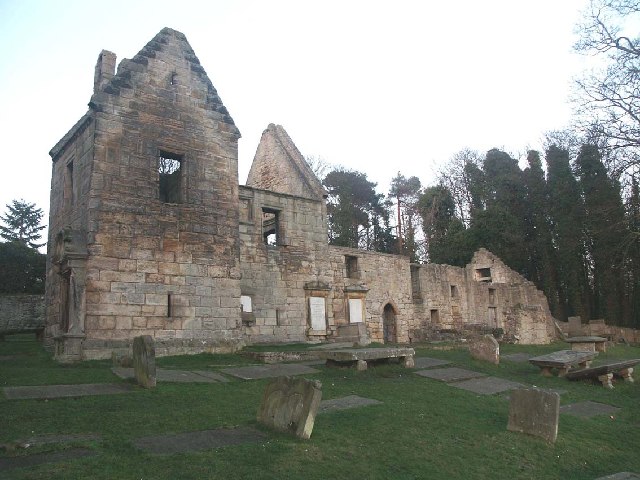
| Description | 12th century worship now in ruins. Altered in the 17th century for Protestant worship. Chancellor Seton, first Earl of Dunfermline is buried in a vault to the West. The Barnbougle Moubray family, who settled here in 1511, have plenty of burial plots. The Moubrays appear to have a vein of seaman running through the family. Many distinguished Naval careers. Many tombstones feature the eerie skull and crossbones | ||
| Date | |||
| Source | https://www.geograph.org.uk/photo/125230 | ||
| Author | Simon Johnston | ||
| Permission (Reusing this file) |
This file is licensed under the Creative Commons Attribution-Share Alike 2.0 Generic license. Attribution: Simon Johnston
|

| Object location | | View this and other nearby images on: OpenStreetMap |
|---|
_&language=en)
File history
Click on a date/time to view the file as it appeared at that time.
| Date/Time | Thumbnail | Dimensions | User | Comment | |
|---|---|---|---|---|---|
| current | 19:41, 11 August 2008 | | 640 × 480 (95 KB) | RMHED (talk | contribs) | {{Information |Description=12th century worship now in ruins. Altered in the 17th century for Protestant worship. Chancellor Seton, first Earl of Dunfermline is buried in a vault to the West. The Barnbougle Moubray family, who settled here in 1511, have p |
You cannot overwrite this file.
File usage on Commons
The following page uses this file:
File usage on other wikis
The following other wikis use this file:
- Usage on cy.wikipedia.org
- Usage on en.wikipedia.org
- Usage on gd.wikipedia.org
- Usage on it.wikipedia.org
- Usage on www.wikidata.org