File:St Sebastian's School - (now L'Arche ) Lockerby Road - geograph.org.uk - 930388.jpg
_Lockerby_Road_-_geograph.org.uk_-_930388.jpg&redirect=no)
St_Sebastian's_School_-_(now_L'Arche_)_Lockerby_Road_-_geograph.org.uk_-_930388.jpg (640 × 480 pixels, file size: 72 KB, MIME type: image/jpeg)
Captions
Captions
Summary
[edit]_Lockerby_Road_-_geograph.org.uk_-_930388.jpg&action=edit§ion=1)
| Description |
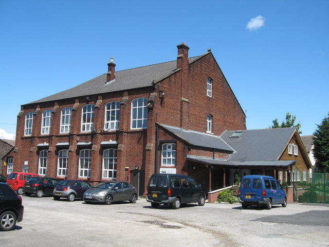
English: St Sebastian's School - (now LArche ) Lockerby Road St Sebastian's School first opened in May 1909 with 131 pupils. The school moved to a new building in Holly Road in 1980 but the old school is still in use today by the L"Arche community.
"LArche Liverpool is Christian Community of 150 people in central Liverpool where people with and without learning disabilities live and work together. It was a Dominican priest called Père Thomas Philippe who helped Jean Vanier 'begin something' with people with learning disabilities, about 40 years ago in France. Jean, originally an officer in the Royal Navy, had become an academic in Canada, but he felt increasingly called to this different life. He met two men called Raphael Simi and Philippe Seux who were living in a large institution near Paris - the only home they'd known for many years. Jean invited them to come and make a home with him. He knew he could not help everyone, but that by helping a few, together they might be a sign to others. L'Arche first arrived in the UK in 1974 with help from Jean's sister, Thérèse, a London doctor. The first community opened in Kent. There are now nine communities in the UK." Information taken from the website below: http://www.larcheliverpool.org/index.php |
| Date | |
| Source | From geograph.org.uk |
| Author | Sue Adair |
| Attribution (required by the license) | Sue Adair / St Sebastian's School - (now L’Arche ) Lockerby Road / |
| Camera location | | View this and other nearby images on: OpenStreetMap |
|---|
_Lockerby_Road_-_geograph.org.uk_-_930388.jpg¶ms=053.412240_N_-002.940300_E_globe:Earth_type:camera_source:geograph-osgb36(SJ37599101)_heading:67.00&language=en)
| Object location | | View this and other nearby images on: OpenStreetMap |
|---|
_Lockerby_Road_-_geograph.org.uk_-_930388.jpg¶ms=053.412420_N_-002.939600_E_globe:Earth_class:object_type:object_source:geograph-osgb36(SJ37649103)_heading:67.00&language=en)
Licensing
[edit]_Lockerby_Road_-_geograph.org.uk_-_930388.jpg&action=edit§ion=2)

|
This image was taken from the Geograph project collection. See this photograph's page on the Geograph website for the photographer's contact details. The copyright on this image is owned by Sue Adair and is licensed for reuse under the Creative Commons Attribution-ShareAlike 2.0 license.
|
- You are free:
- to share – to copy, distribute and transmit the work
- to remix – to adapt the work
- Under the following conditions:
- attribution – You must give appropriate credit, provide a link to the license, and indicate if changes were made. You may do so in any reasonable manner, but not in any way that suggests the licensor endorses you or your use.
- share alike – If you remix, transform, or build upon the material, you must distribute your contributions under the same or compatible license as the original.
File history
Click on a date/time to view the file as it appeared at that time.
| Date/Time | Thumbnail | Dimensions | User | Comment | |
|---|---|---|---|---|---|
| current | 07:41, 22 February 2011 | | 640 × 480 (72 KB) | GeographBot (talk | contribs) | == {{int:filedesc}} == {{Information |description={{en|1=St Sebastian's School - (now LArche ) Lockerby Road St Sebastian's School first opened in May 1909 with 131 pupils. The school moved to a new building in Holly Road in 1980 but the old school is |
You cannot overwrite this file.
File usage on Commons
The following page uses this file:
File usage on other wikis
The following other wikis use this file:
- Usage on ca.wikipedia.org
_Lockerby_Road_-_geograph.org.uk_-_930388.jpg&oldid=904028319)