File:Stone sign at Agamon Hula lookout.JPG

Original file (4,608 × 3,072 pixels, file size: 8.35 MB, MIME type: image/jpeg)
Captions
Captions
Summary
[edit]| Description |
Deutsch: Auf der Steintafel steht:
English: Auf der Steintafel steht:
|
| Date | |
| Source | Own work |
| Author | Jotpe |
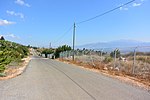
| Place[1] | Deutsch: Israel National Trail, Nebi Yosha Forest, Mevoot HaHermon Regional Council, Nordbezirk, Israel English: Israel National Trail, Nebi Yosha Forest, Mevoot HaHermon Regional Council, North District, Israel עברית: Israel National Trail, יער נבי יושע, מועצה אזורית מבואות החרמון, מחוז הצפון, ישראל |
| Image Number | 142 |
| Height | 404 |
| Camera location | | View this and other nearby images on: OpenStreetMap |
|---|
Navigation for Fotoproject Israel National Trail 2014
[edit]-
 Direction stone at Agamon Hula lookout.JPG
 -
 Stone sign at Agamon Hula lookout.JPG
 -
 6 Black Kites over Naftali Mountains.JPG
 -
 3 Black Kites over Naftali Mountains.JPG
 -
 12 Black Kites over Naftali Mountains.JPG
 -
 View from Ramot Naftali to Hermon Mountain.JPG


The production, editing or release of this file was supported by the Community-Budget of Wikimedia Deutschland. To see other files made with the support of Wikimedia Deutschland, please see the category Supported by Wikimedia Deutschland. |
Licensing
[edit]
- You are free:
- to share – to copy, distribute and transmit the work
- to remix – to adapt the work
- Under the following conditions:
- attribution – You must give appropriate credit, provide a link to the license, and indicate if changes were made. You may do so in any reasonable manner, but not in any way that suggests the licensor endorses you or your use.
- share alike – If you remix, transform, or build upon the material, you must distribute your contributions under the same or compatible license as the original.
Notes for Share Alike in Openstreetmap
[edit]Sources
[edit]
File history
Click on a date/time to view the file as it appeared at that time.
| Date/Time | Thumbnail | Dimensions | User | Comment | |
|---|---|---|---|---|---|
| current | 06:54, 14 February 2015 | | 4,608 × 3,072 (8.35 MB) | Jotpe (talk | contribs) |
You cannot overwrite this file.
File usage on Commons
The following 8 pages use this file:
- User:A.Savin/Archive/2015/2
- User:Nicolas Rück (WMDE)/Supported by Wikimedia Deutschland 2015/3
- File:3 Black Kites over Naftali Mountains.JPG
- File:6 Black Kites over Naftali Mountains.JPG
- File:Direction stone at Agamon Hula lookout.JPG
- File:Stone sign at Agamon Hula lookout.JPG
- File:View from Ramot Naftali to Hermon Mountain.JPG
- File:View from Ramot Naftali to Keren Naftali.JPG