File:Straube Monumental-Plan der Reichshauptstadt Berlin 1896.jpg
Jump to navigation
Jump to search

Size of this preview: 740 × 599 pixels. Other resolutions: 296 × 240 pixels | 593 × 480 pixels | 948 × 768 pixels | 1,264 × 1,024 pixels | 2,529 × 2,048 pixels | 5,765 × 4,669 pixels.
Original file (5,765 × 4,669 pixels, file size: 12.89 MB, MIME type: image/jpeg)
Captions
Captions
Add a one-line explanation of what this file represents
Summary[edit]
| Title |
Monumental-Plan der Reichshauptstadt Berlin mit nächster Umgebung |
| Description |
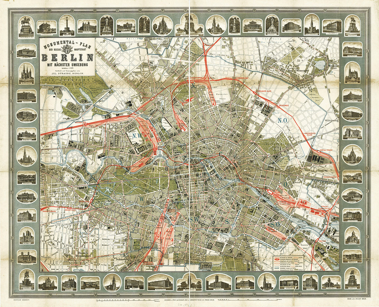
Deutsch: Der Titel steht 4-zeilig links oben gerahmt im Plan. Unter dem Plan zwei Maßstabsleisten über 2000 Meter und 2500 Schritt. Der Plan ist unterteilt in Planquadrate A-M und 1-10. Um den Plan, innerhalb des Rahmens gruppieren sich 54 Ansichten bedeutender Bauten mit dem über Planquadrate verorteten Standort. Der Plan erschien in: Straube's Verkehrs-Handbuch. Berlin und seine Umgebung in Karten, Wort und Bild. |
| Date | |
| Source | Landesarchiv Berlin (online) |
| Creator | |
| Geotemporal data | |
| Map location | Berlin |
| Scale | 1:17,777 |
| Heading |
 |
| Georeferencing | If inappropriate please set warp_status = skip to hide. |
| Bibliographic data | |
| Language | German |
| Archival data | |
| Collection | Landesarchiv Berlin |
| Accession number |
F Rep. 270, A 8425/1 |
| Dimensions | height: 62.8 cm (24.7 in); width: 77.6 cm (30.5 in) (height: 49.9 cm (19.6 in); width: 64.4 cm (25.3 in) map size) |
| Medium | chromolithograph |
| Notes |
Literatur
|
| Other versions |
|


Licensing[edit]
|
This is a faithful photographic reproduction of a two-dimensional, public domain work of art. The work of art itself is in the public domain for the following reason:
The official position taken by the Wikimedia Foundation is that "faithful reproductions of two-dimensional public domain works of art are public domain".
This photographic reproduction is therefore also considered to be in the public domain in the United States. In other jurisdictions, re-use of this content may be restricted; see Reuse of PD-Art photographs for details. | ||||
File history
Click on a date/time to view the file as it appeared at that time.
| Date/Time | Thumbnail | Dimensions | User | Comment | |
|---|---|---|---|---|---|
| current | 22:00, 26 February 2013 | | 5,765 × 4,669 (12.89 MB) | Alexrk2 (talk | contribs) | == {{int:description}} == {{InteractiveViewer}} {{Information |Description='''Monumental-Plan der Reichshauptstadt Berlin''' mit nächster Umgebung * Format: 77,6 x 62,8 cm (64,0 x 49,9 nur der Plan) * Maßstab: 1: 17 777 * Orientierung: ... |
You cannot overwrite this file.
File usage on Commons
The following 2 pages use this file: