File:Syayou-kan , 太宰治記念館 斜陽館 - panoramio (1).jpg
Jump to navigation
Jump to search

Size of this preview: 800 × 368 pixels. Other resolutions: 320 × 147 pixels | 640 × 295 pixels | 1,024 × 472 pixels | 1,280 × 590 pixels | 3,474 × 1,600 pixels.
Original file (3,474 × 1,600 pixels, file size: 701 KB, MIME type: image/jpeg)
Captions
Captions
Add a one-line explanation of what this file represents
Summary[edit]
.jpg&action=edit§ion=1)
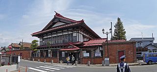
| Description | Syayou-kan , 太宰治記念館 斜陽館 | ||
| Date | Taken on 28 April 2014 | ||
| Source | https://web.archive.org/web/20161027190245/http://www.panoramio.com/photo/107351424 | ||
| Author | z tanuki | ||
| Permission (Reusing this file) |
This file is licensed under the Creative Commons Attribution 3.0 Unported license. Attribution: z tanuki
|
||
| Tags (from Panoramio photo page) | Goshogawara-shi, 2014, 五所川原市, 日本, 青森県 |
| Camera location | | View this and other nearby images on: OpenStreetMap |
|---|
.jpg¶ms=040.902572_N_0140.455024_E_globe:Earth_type:camera_source:Panoramio_&language=en)
File history
Click on a date/time to view the file as it appeared at that time.
| Date/Time | Thumbnail | Dimensions | User | Comment | |
|---|---|---|---|---|---|
| current | 09:11, 8 April 2017 | | 3,474 × 1,600 (701 KB) | Panoramio upload bot (talk | contribs) | == {{int:filedesc}} == {{Information |description=Syayou-kan , 太宰治記念館 斜陽館 |date={{Taken on|2014-04-28}} |source=http://www.panoramio.com/photo/107351424 |author=[http://www.panoramio.com/user/238971?with_photo_id=107351424 z tanuki] |... |
You cannot overwrite this file.
File usage on Commons
The following page uses this file:
File usage on other wikis
The following other wikis use this file:
- Usage on www.wikidata.org
- Usage on zh.wikipedia.org
.jpg&oldid=477994272)