File:Tarnogsky District (Vologda Oblast, 2009).svg
Jump to navigation
Jump to search

Size of this PNG preview of this SVG file: 171 × 171 pixels. Other resolutions: 240 × 240 pixels | 480 × 480 pixels | 768 × 768 pixels | 1,024 × 1,024 pixels | 2,048 × 2,048 pixels.
Original file (SVG file, nominally 171 × 171 pixels, file size: 23 KB)
Captions
Captions
Add a one-line explanation of what this file represents
| Description |
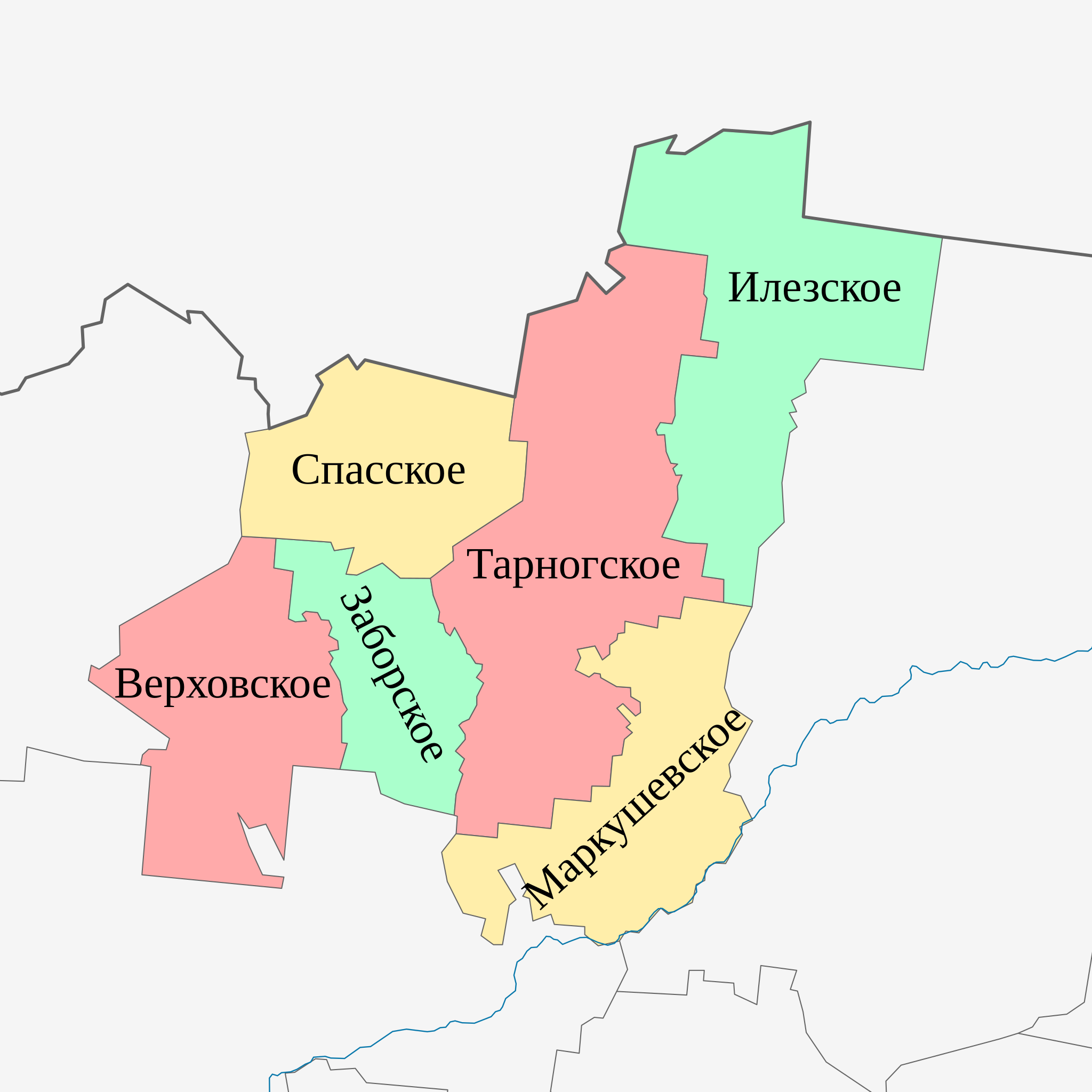
Русский: Муниципальные образования Тарногского района Вологодской области, 2009 год Равноугольная проекция, растяжение — 200 %. Координаты краёв: * север — 61.2° С * юг — 60.0° С * восток — 44.8° В * запад — 42.4° В |
| Date | (UTC) |
| Source | |
| Author |
|
.svg)
| This is a retouched picture, which means that it has been digitally altered from its original version. Modifications: colors and names. The original can be viewed here: Outline Map of Tarnogsky District (Vologda Oblast, 2009).svg:
|
I, the copyright holder of this work, hereby publish it under the following license:
| I, the copyright holder of this work, release this work into the public domain. This applies worldwide. In some countries this may not be legally possible; if so: I grant anyone the right to use this work for any purpose, without any conditions, unless such conditions are required by law. |
Original upload log[edit]
.svg&action=edit§ion=1)
This image is a derivative work of the following images:
- File:Outline_Map_of_Tarnogsky_District_(Vologda_Oblast,_2009).svg licensed with PD-self
- 2010-08-11T14:42:07Z Виктор В 171x171 (16269 Bytes) == {{int:filedesc}} == {{Information |Description={{ru|1=Позиционная карта Тарногского района Вологодской области, 2009 годРавноугольная проекция, р�
Uploaded with derivativeFX
File history
Click on a date/time to view the file as it appeared at that time.
| Date/Time | Thumbnail | Dimensions | User | Comment | |
|---|---|---|---|---|---|
| current | 12:12, 19 August 2010 | | 171 × 171 (23 KB) | Daryona (talk | contribs) | {{Information |Description={{ru|1=Муниципальные образования Тарногского района Вологодской области, 2009 год<br>Равноугольная проекция, растяжение — 200 %. Ко |
You cannot overwrite this file.
File usage on Commons
There are no pages that use this file.
File usage on other wikis
The following other wikis use this file:
- Usage on fi.wikipedia.org
- Usage on ru.wikipedia.org
.svg&oldid=513220905)