File:The Pentargon Valley - geograph.org.uk - 1493043.jpg
Jump to navigation
Jump to search
No higher resolution available.
The_Pentargon_Valley_-_geograph.org.uk_-_1493043.jpg (640 × 426 pixels, file size: 116 KB, MIME type: image/jpeg)
Captions
Captions
Add a one-line explanation of what this file represents
Summary[edit]
| Description |
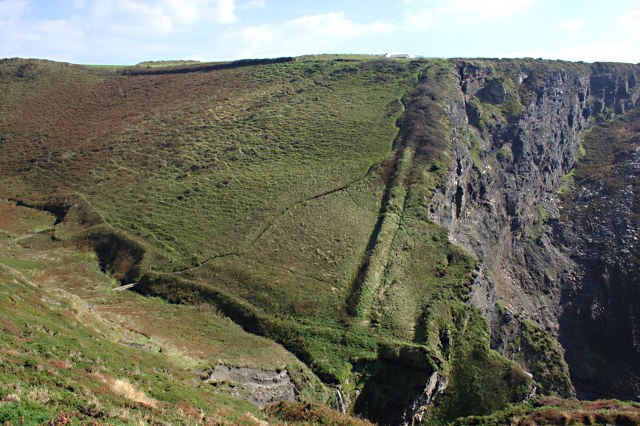
English: The Pentargon Valley This valley ends in a sheer drop towards the sea. The little stream drops down a waterfall which can just be seen centre bottom of the photo. With vertical cliff faces all around, walkers are advised not to go wandering off the coast path. |
| Date | |
| Source | From geograph.org.uk |
| Author | Tony Atkin |
| Attribution (required by the license) | Tony Atkin / The Pentargon Valley / |
| Camera location | | View this and other nearby images on: OpenStreetMap |
|---|
| Object location | | View this and other nearby images on: OpenStreetMap |
|---|
Licensing[edit]

|
This image was taken from the Geograph project collection. See this photograph's page on the Geograph website for the photographer's contact details. The copyright on this image is owned by Tony Atkin and is licensed for reuse under the Creative Commons Attribution-ShareAlike 2.0 license.
|
This file is licensed under the Creative Commons Attribution-Share Alike 2.0 Generic license.
Attribution: Tony Atkin
- You are free:
- to share – to copy, distribute and transmit the work
- to remix – to adapt the work
- Under the following conditions:
- attribution – You must give appropriate credit, provide a link to the license, and indicate if changes were made. You may do so in any reasonable manner, but not in any way that suggests the licensor endorses you or your use.
- share alike – If you remix, transform, or build upon the material, you must distribute your contributions under the same or compatible license as the original.

_heading:135.00&language=en)
_heading:135.00&language=en)
File history
Click on a date/time to view the file as it appeared at that time.
| Date/Time | Thumbnail | Dimensions | User | Comment | |
|---|---|---|---|---|---|
| current | 18:42, 2 March 2011 | | 640 × 426 (116 KB) | GeographBot (talk | contribs) | == {{int:filedesc}} == {{Information |description={{en|1=The Pentargon Valley This valley ends in a sheer drop towards the sea. The little stream drops down a waterfall which can just be seen centre bottom of the photo. With vertical cliff faces all aroun |
You cannot overwrite this file.
File usage on Commons
There are no pages that use this file.