File:Three Counties railway station.jpg
Jump to navigation
Jump to search
No higher resolution available.
Three_Counties_railway_station.jpg (640 × 480 pixels, file size: 101 KB, MIME type: image/jpeg)
Captions
Captions
Add a one-line explanation of what this file represents
Summary
[edit]
| Description |
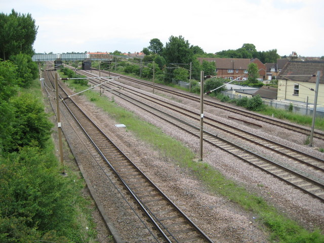
English: The Great Northern Railway was completed through here in 1850 and a station, called Arlesey Siding and named because of the sidings to the nearby brick works, was built here in 1866. With the expansion of the nearby Three Counties Lunatic Asylum the station was renamed Three Counties railway station in 1886. It closed in 1959. Looking at old maps the actual site of the station was about two thirds of the way towards the distant Mill Lane road bridge. This was the site of a fatal railway accident in 1876 when a northbound express passenger train collided with a derailed luggage train. |
| Date | |
| Source | From geograph.org.uk |
| Author | Nigel Cox |
| Attribution (required by the license) | Nigel Cox / Arlesey: Site of the former Three Counties railway station / |
| Camera location | | View this and other nearby images on: OpenStreetMap |
|---|
_heading:0.00&language=en)
| Object location | | View this and other nearby images on: OpenStreetMap |
|---|
_heading:0.00&language=en)
Licensing
[edit]

|
This image was taken from the Geograph project collection. See this photograph's page on the Geograph website for the photographer's contact details. The copyright on this image is owned by Nigel Cox and is licensed for reuse under the Creative Commons Attribution-ShareAlike 2.0 license.
|
This file is licensed under the Creative Commons Attribution-Share Alike 2.0 Generic license.
Attribution: Nigel Cox
- You are free:
- to share – to copy, distribute and transmit the work
- to remix – to adapt the work
- Under the following conditions:
- attribution – You must give appropriate credit, provide a link to the license, and indicate if changes were made. You may do so in any reasonable manner, but not in any way that suggests the licensor endorses you or your use.
- share alike – If you remix, transform, or build upon the material, you must distribute your contributions under the same or compatible license as the original.
File history
Click on a date/time to view the file as it appeared at that time.
| Date/Time | Thumbnail | Dimensions | User | Comment | |
|---|---|---|---|---|---|
| current | 10:18, 1 October 2010 | | 640 × 480 (101 KB) | Lamberhurst (talk | contribs) | == {{int:filedesc}} == {{Information |description={{en|1=The Great Northern Railway was completed through here in 1850 and a station, called Arlesey Siding and named because of the sidings to the nearby brick works, was built here in 1866. With the expans |
You cannot overwrite this file.
File usage on Commons
The following page uses this file:
File usage on other wikis
The following other wikis use this file:
- Usage on en.wikipedia.org
- Usage on www.wikidata.org