File:Thuringia location map simplified.svg
Jump to navigation
Jump to search

Size of this PNG preview of this SVG file: 726 × 599 pixels. Other resolutions: 291 × 240 pixels | 582 × 480 pixels | 930 × 768 pixels | 1,240 × 1,024 pixels | 2,481 × 2,048 pixels | 2,809 × 2,319 pixels.
Original file (SVG file, nominally 2,809 × 2,319 pixels, file size: 44 KB)
Captions
Captions
Add a one-line explanation of what this file represents
| Description |
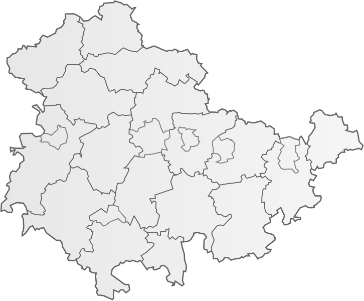
Deutsch: Landkreise und kreisfreie Städte in Thuringia.
English: Rural and urban districts of Thuringia. |
| Date | (UTC) |
| Source | |
| Author |
|
I, the copyright holder of this work, hereby publish it under the following licenses:

|
The copyright holder of this file allows anyone to use it for any purpose, provided that the copyright holder is properly attributed. Redistribution, derivative work, commercial use, and all other use is permitted. |
|
|
This file is licensed under the Creative Commons Attribution 3.0 Unported, 2.5 Generic, 2.0 Generic and 1.0 Generic license.
- You are free:
- to share – to copy, distribute and transmit the work
- to remix – to adapt the work
- Under the following conditions:
- attribution – You must give appropriate credit, provide a link to the license, and indicate if changes were made. You may do so in any reasonable manner, but not in any way that suggests the licensor endorses you or your use.
This file is licensed under the Creative Commons Attribution-Share Alike 3.0 Unported, 2.5 Generic, 2.0 Generic and 1.0 Generic license.
- You are free:
- to share – to copy, distribute and transmit the work
- to remix – to adapt the work
- Under the following conditions:
- attribution – You must give appropriate credit, provide a link to the license, and indicate if changes were made. You may do so in any reasonable manner, but not in any way that suggests the licensor endorses you or your use.
- share alike – If you remix, transform, or build upon the material, you must distribute your contributions under the same or compatible license as the original.
| This file is made available under the Creative Commons CC0 1.0 Universal Public Domain Dedication. | |
| The person who associated a work with this deed has dedicated the work to the public domain by waiving all of their rights to the work worldwide under copyright law, including all related and neighboring rights, to the extent allowed by law. You can copy, modify, distribute and perform the work, even for commercial purposes, all without asking permission.
|
| Copyleft: This work of art is free; you can redistribute it and/or modify it according to terms of the Free Art License. You will find a specimen of this license on the Copyleft Attitude site as well as on other sites. |

|
Permission is granted to copy, distribute and/or modify this document under the terms of the GNU Free Documentation License, Version 1.2 or any later version published by the Free Software Foundation; with no Invariant Sections, no Front-Cover Texts, and no Back-Cover Texts. A copy of the license is included in the section entitled GNU Free Documentation License. |
| I, the copyright holder of this work, release this work into the public domain. This applies worldwide. In some countries this may not be legally possible; if so: I grant anyone the right to use this work for any purpose, without any conditions, unless such conditions are required by law. |
You may select the license of your choice.
Original upload log[edit]
This image is a derivative work of the following images:
- File:Landkreise,_Kreise_und_kreisfreie_Städte_in_Deutschland_2011-09-04.svg licensed with Attribution, Cc-by-3.0,2.5,2.0,1.0, Cc-by-sa-3.0,2.5,2.0,1.0, Cc-zero, FAL, GFDL, PD-self
- 2011-03-01T12:49:15Z TUBS 9463x12526 (1655705 Bytes) corr crop area
- 2011-03-01T12:45:23Z TUBS 9450x12513 (1417732 Bytes) corr
- 2011-03-01T12:37:35Z TUBS 9450x12513 (1417732 Bytes) corr crop area
- 2011-03-01T12:31:55Z TUBS 9390x12467 (1417675 Bytes) == {{int:filedesc}} == {{Information |Description= {{de|[[:de:Landkreis|Landkreise]], Kreise und kreisfreie Städte in [[:de:Deutschland|Deutschland]] nach dem 4. September 2011 (nach der [[:de:Kreisgebietsreform Mecklenburg-
Uploaded with derivativeFX
File history
Click on a date/time to view the file as it appeared at that time.
| Date/Time | Thumbnail | Dimensions | User | Comment | |
|---|---|---|---|---|---|
| current | 15:52, 29 September 2011 | | 2,809 × 2,319 (44 KB) | MichaelBueker (talk | contribs) | {{Information |Description={{de|Landkreise und kreisfreie Städte in Thuringia.}} {{en|Rural and urban districts of Thuringia.}} |Source=*File:Landkreise,_Kreise_und_kreisfreie_Städte_in_Deutschland_2011-09-04.svg |Date=2011-09-29 15:51 (UTC) |Auth |
You cannot overwrite this file.
File usage on Commons
The following page uses this file: