File:Tikkurilankoski rapid in Vantaa, Finland, 2019 November.jpg
Jump to navigation
Jump to search
Size of this preview: 800 × 554 pixels. Other resolutions: 320 × 222 pixels | 640 × 443 pixels | 1,024 × 709 pixels | 1,280 × 887 pixels | 2,560 × 1,774 pixels | 5,000 × 3,464 pixels.
Original file (5,000 × 3,464 pixels, file size: 4.17 MB, MIME type: image/jpeg)
Captions
Captions
Add a one-line explanation of what this file represents
Summary
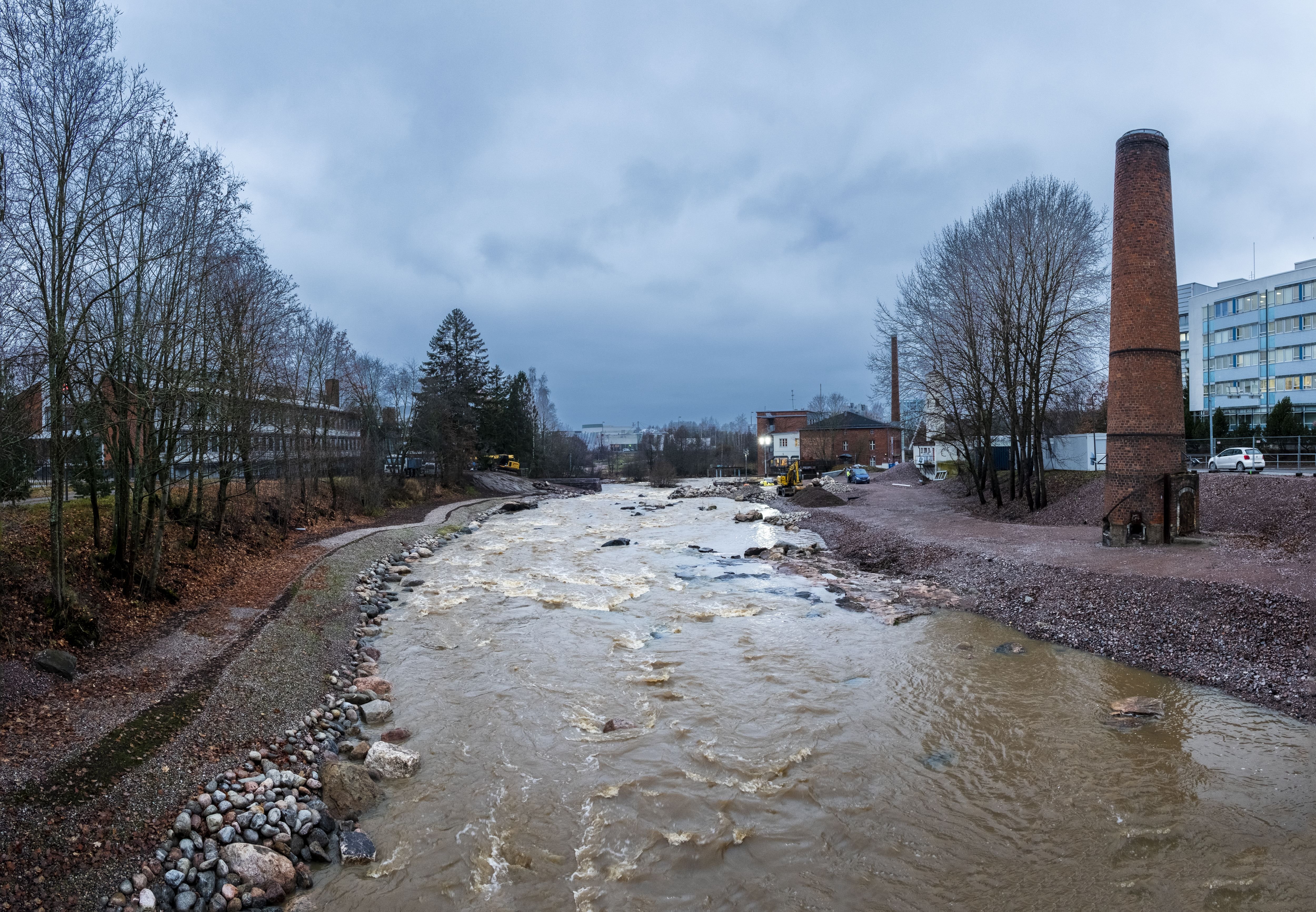
[edit]| Tikkurilankoski
|
|||||||||||||||||||||
|---|---|---|---|---|---|---|---|---|---|---|---|---|---|---|---|---|---|---|---|---|---|
| Photographer |
Eero Happonen |
 | |||||||||||||||||||
| Title |
Tikkurilankoski rapid in Vantaa, Finland, 2019 November |
||||||||||||||||||||
| Part of |
Keravanjoki |
||||||||||||||||||||
| Object type |
rapids |
||||||||||||||||||||
| Description |
English: Tikkurilankoski is a rapid shared by Jokiniemi and Kuninkaala districts in Vantaa, Finland. Suomi: Vantaan Tikkurilankoski kuuluu Jokiniemen ja Kuninkaalan kaupunginosiin. Aiemmin koski oli padottu, mutta pato purettiin kesällä 2019. Taustalla Vernissatehtaan luona näkyy koskirannan kunnostustöitä. |
||||||||||||||||||||
| Depicted place | Tikkurilankoski in Vantaa, Finland | ||||||||||||||||||||
| Date | 19 November 2019 | ||||||||||||||||||||
| Collection |
|
||||||||||||||||||||
| Accession number |
1484:5 |
||||||||||||||||||||
| Object location |
|
||||||||||||||||||||
| Source | Finna: Tikkurilankoski ja Vernissaranta | ||||||||||||||||||||
| Permission (Reusing this file) |
CC BY 4.0 | ||||||||||||||||||||
| Other versions |
|
||||||||||||||||||||


| Camera location | | View this and other nearby images on: OpenStreetMap |
|---|
Licensing
[edit]
This file is licensed under the Creative Commons Attribution-Share Alike 4.0 International license.
- You are free:
- to share – to copy, distribute and transmit the work
- to remix – to adapt the work
- Under the following conditions:
- attribution – You must give appropriate credit, provide a link to the license, and indicate if changes were made. You may do so in any reasonable manner, but not in any way that suggests the licensor endorses you or your use.
- share alike – If you remix, transform, or build upon the material, you must distribute your contributions under the same or compatible license as the original.
This file is digitized and shared in Wikimedia Commons by the Vantaa City Museum. This tag does not indicate the copyright status of the attached work. A normal copyright tag is still required. See Commons:Licensing.
|
| Annotations | This image is annotated: View the annotations at Commons |
File history
Click on a date/time to view the file as it appeared at that time.
| Date/Time | Thumbnail | Dimensions | User | Comment | |
|---|---|---|---|---|---|
| current | 13:18, 18 July 2021 | | 5,000 × 3,464 (4.17 MB) | Coen (talk | contribs) | Uploaded a work by Eero Happonen from https://www.finna.fi/Record/vantaa.kuva:1484:5 with UploadWizard |
You cannot overwrite this file.
File usage on Commons
The following page uses this file: