File:Topographical map of Garibaldi Provincial Park.jpg
Jump to navigation
Jump to search

Size of this preview: 335 × 598 pixels. Other resolutions: 134 × 240 pixels | 269 × 480 pixels | 430 × 768 pixels | 573 × 1,024 pixels | 1,147 × 2,048 pixels | 8,271 × 14,771 pixels.
Original file (8,271 × 14,771 pixels, file size: 24.33 MB, MIME type: image/jpeg)
Captions
Captions
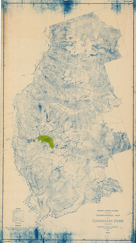
Topographical map of Garibaldi Provincial Park, drafted 1928
Summary[edit]
| Warning | The original file is very high-resolution. It might not load properly or could cause your browser to freeze when opened at full size. |
|---|
| Description |
English: Topographical map of Garibaldi Provincial Park, drafted 1928. The map is displayed on aged paper, and drawn with fine blue lines. Ink stains appear at the top and bottom of the page, and one area near the middle left, Garibaldi Lake, is highlighted in green. |
| Date | |
| Source | https://searcharchives.vancouver.ca/topographical-map-of-garibaldi-lake |
| Author | Vancouver BC Office of the City Engineer |
Licensing[edit]
| This file is made available under the Creative Commons CC0 1.0 Universal Public Domain Dedication. | |
| The person who associated a work with this deed has dedicated the work to the public domain by waiving all of their rights to the work worldwide under copyright law, including all related and neighboring rights, to the extent allowed by law. You can copy, modify, distribute and perform the work, even for commercial purposes, all without asking permission.
|
File history
Click on a date/time to view the file as it appeared at that time.
| Date/Time | Thumbnail | Dimensions | User | Comment | |
|---|---|---|---|---|---|
| current | 20:30, 6 June 2019 | | 8,271 × 14,771 (24.33 MB) | Luidias (talk | contribs) | User created page with UploadWizard |
You cannot overwrite this file.
File usage on Commons
There are no pages that use this file.
File usage on other wikis
The following other wikis use this file:
- Usage on en.wikipedia.org