File:Tuba from North 2.JPG
Jump to navigation
Jump to search

Size of this preview: 800 × 249 pixels. Other resolutions: 320 × 100 pixels | 1,440 × 448 pixels.
Original file (1,440 × 448 pixels, file size: 88 KB, MIME type: image/jpeg)
Captions
Captions
Add a one-line explanation of what this file represents
| Description |
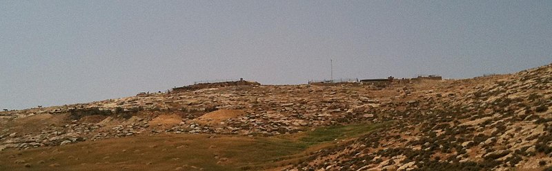
English: Bedouine village in south Mt. Hebron, West Bank. Long 35 10' 31 Lat 31 24' 28. The pole seen in the photo is a wind turbine which provides electricity to the village (which is not connected to any regular power grid). |
| Date | (UTC) |
| Source | |
| Author |
|
| Camera location | | View this and other nearby images on: OpenStreetMap |
|---|
| This is a retouched picture, which means that it has been digitally altered from its original version. The original can be viewed here: Tuba from North.JPG:
|
I, the copyright holder of this work, hereby publish it under the following licenses:
This file is licensed under the Creative Commons Attribution-Share Alike 3.0 Unported license.
- You are free:
- to share – to copy, distribute and transmit the work
- to remix – to adapt the work
- Under the following conditions:
- attribution – You must give appropriate credit, provide a link to the license, and indicate if changes were made. You may do so in any reasonable manner, but not in any way that suggests the licensor endorses you or your use.
- share alike – If you remix, transform, or build upon the material, you must distribute your contributions under the same or compatible license as the original.

|
Permission is granted to copy, distribute and/or modify this document under the terms of the GNU Free Documentation License, Version 1.2 or any later version published by the Free Software Foundation; with no Invariant Sections, no Front-Cover Texts, and no Back-Cover Texts. A copy of the license is included in the section entitled GNU Free Documentation License. |
You may select the license of your choice.
Original upload log[edit]
This image is a derivative work of the following images:
- File:Tuba_from_North.JPG licensed with Cc-by-sa-3.0, GFDL
- 2010-04-19T14:33:20Z Shy halatzi 2048x1536 (1260337 Bytes) {{Information |Description={{en|1=Bedouine village in south Mt. Hebron, West Bank. Long 35 10' 31'' Lat 31 24' 28''. The pole seen in the photo is a wind turbine which provides electricity to the village (which is not connect
Uploaded with derivativeFX
File history
Click on a date/time to view the file as it appeared at that time.
| Date/Time | Thumbnail | Dimensions | User | Comment | |
|---|---|---|---|---|---|
| current | 03:36, 20 April 2010 | 1,440 × 448 (88 KB) | דוד שי (talk | contribs) | {{Information |Description={{en|1=Bedouine village in south Mt. Hebron, West Bank. Long 35 10' 31'' Lat 31 24' 28''. The pole seen in the photo is a wind turbine which provides electricity to the village (which is not connected to any regular power grid). |
You cannot overwrite this file.
File usage on Commons
There are no pages that use this file.
File usage on other wikis
The following other wikis use this file:
- Usage on he.wikipedia.org
- Usage on ru.wikipedia.org