File:TuresValleyRailroadMap.svg
Jump to navigation
Jump to search

Size of this PNG preview of this SVG file: 238 × 600 pixels. Other resolutions: 95 × 240 pixels | 190 × 480 pixels | 304 × 768 pixels | 406 × 1,024 pixels | 812 × 2,048 pixels | 909 × 2,291 pixels.
Original file (SVG file, nominally 909 × 2,291 pixels, file size: 330 KB)
Captions
Captions
Add a one-line explanation of what this file represents
Summary[edit]
| Description |
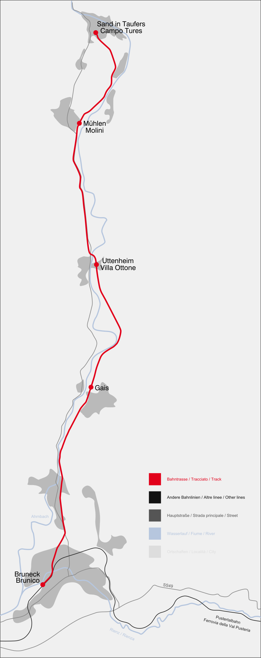
Deutsch: Karte der Tauferer Bahn.
English: Map of the Tures Valley Railroad.
Italiano: Mappa della ferrovia Brunico-Campo Tures. |
||
| Source | Own work | ||
| Author | Luigino | ||
| Permission (Reusing this file) |
|
This W3C-unspecified vector image was created with Inkscape .
File history
Click on a date/time to view the file as it appeared at that time.
| Date/Time | Thumbnail | Dimensions | User | Comment | |
|---|---|---|---|---|---|
| current | 21:28, 24 November 2014 | 909 × 2,291 (330 KB) | Arbalete (talk | contribs) | Correggo | |
| 15:16, 2 January 2007 |  | 2,980 × 4,213 (68 KB) | Luigino (talk | contribs) | {{Information |Description=Map of the Tures Valley Railroad / Karte der Tauferer Bahn / Mappa della ferrovia della valle di Tures |Source=own work |Date=02.01.2007 |Author=~~~ |Permission= |other_versions= }} |
You cannot overwrite this file.
File usage on Commons
The following page uses this file:
File usage on other wikis
The following other wikis use this file:
- Usage on de.wikipedia.org
- Usage on en.wikipedia.org
- Usage on hu.wikipedia.org
- Usage on it.wikipedia.org
- Usage on www.wikidata.org