File:Tuusula - Kellokoski - Keravanjoki river - panoramio (1).jpg
Jump to navigation
Jump to search

Size of this preview: 800 × 501 pixels. Other resolutions: 320 × 201 pixels | 640 × 401 pixels | 1,024 × 642 pixels | 1,280 × 802 pixels | 2,560 × 1,604 pixels | 4,141 × 2,595 pixels.
Original file (4,141 × 2,595 pixels, file size: 4.44 MB, MIME type: image/jpeg)
Captions
Captions
Add a one-line explanation of what this file represents
Summary
[edit].jpg&action=edit§ion=1)
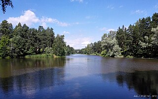
| Description | Tuusula / Kellokoski - Keravanjoki river | ||
| Date | Taken on 7 July 2014 | ||
| Source | https://web.archive.org/web/20161030100111/http://www.panoramio.com/photo/109026480 | ||
| Author | Arto J | ||
| Permission (Reusing this file) |
This file is licensed under the Creative Commons Attribution-Share Alike 3.0 Unported license. Attribution: Arto J
|
||
| Tags (from Panoramio photo page) | Tuusula, Keravanjoki River, River, Tuusula |
| Camera location | | View this and other nearby images on: OpenStreetMap |
|---|
.jpg¶ms=060.531840_N_0025.106789_E_globe:Earth_type:camera_source:Panoramio_&language=en)
File history
Click on a date/time to view the file as it appeared at that time.
| Date/Time | Thumbnail | Dimensions | User | Comment | |
|---|---|---|---|---|---|
| current | 21:49, 13 April 2017 | | 4,141 × 2,595 (4.44 MB) | Panoramio upload bot (talk | contribs) | == {{int:filedesc}} == {{Information |description=Tuusula / Kellokoski - Keravanjoki river |date={{Taken on|2014-07-07}} |source=http://www.panoramio.com/photo/109026480 |author=[http://www.panoramio.com/user/4037653?with_photo_id=109026480 Arto J] |pe... |
You cannot overwrite this file.
File usage on Commons
There are no pages that use this file.
.jpg&oldid=642452355)