File:Tyneham Farm - geograph.org.uk - 645510.jpg
Jump to navigation
Jump to search
No higher resolution available.
Tyneham_Farm_-_geograph.org.uk_-_645510.jpg (640 × 480 pixels, file size: 96 KB, MIME type: image/jpeg)
Captions
Captions
Add a one-line explanation of what this file represents
Summary
[edit]
| Description |
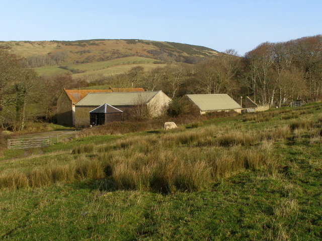
English: Tyneham Farm The buildings here are those of Tyneham Farm, viewed from the footpath up to the top of Gad Cliff. Povington Hill is in the background, part of the chalk ridge that forms the spine of the Purbeck Hills. This area was commandeered by the War Office in December 1943, and is still used as a firing range. This farm operates within the constraints of a live firing range. Public access is only possible along the Range Walks when the range is not active. |
| Date | |
| Source | From geograph.org.uk |
| Author | Jim Champion |
| Attribution (required by the license) | Jim Champion / Tyneham Farm / |
| Camera location | | View this and other nearby images on: OpenStreetMap |
|---|
_heading:22.00&language=en)
| Object location | | View this and other nearby images on: OpenStreetMap |
|---|
_heading:22.00&language=en)
Licensing
[edit]

|
This image was taken from the Geograph project collection. See this photograph's page on the Geograph website for the photographer's contact details. The copyright on this image is owned by Jim Champion and is licensed for reuse under the Creative Commons Attribution-ShareAlike 2.0 license.
|
This file is licensed under the Creative Commons Attribution-Share Alike 2.0 Generic license.
Attribution: Jim Champion
- You are free:
- to share – to copy, distribute and transmit the work
- to remix – to adapt the work
- Under the following conditions:
- attribution – You must give appropriate credit, provide a link to the license, and indicate if changes were made. You may do so in any reasonable manner, but not in any way that suggests the licensor endorses you or your use.
- share alike – If you remix, transform, or build upon the material, you must distribute your contributions under the same or compatible license as the original.
File history
Click on a date/time to view the file as it appeared at that time.
| Date/Time | Thumbnail | Dimensions | User | Comment | |
|---|---|---|---|---|---|
| current | 19:58, 11 March 2011 | | 640 × 480 (96 KB) | GeographBot (talk | contribs) | == {{int:filedesc}} == {{Information |description={{en|1=Tyneham Farm The buildings here are those of Tyneham Farm, viewed from the footpath up to the top of Gad Cliff. Povington Hill is in the background, part of the chalk ridge that forms the spine of t |
You cannot overwrite this file.
File usage on Commons
There are no pages that use this file.