File:US states HDI.png
Jump to navigation
Jump to search
Size of this preview: 800 × 520 pixels. Other resolutions: 320 × 208 pixels | 640 × 416 pixels | 1,024 × 665 pixels | 1,513 × 983 pixels.
Original file (1,513 × 983 pixels, file size: 37 KB, MIME type: image/png)
Captions
Captions
Add a one-line explanation of what this file represents
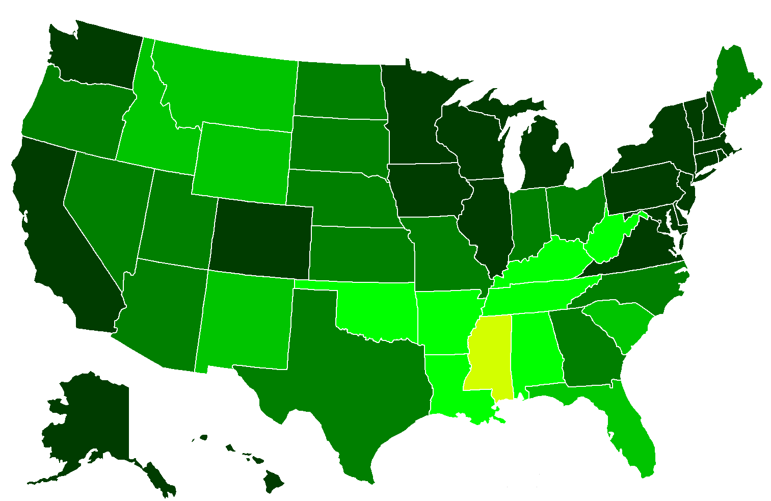
| Description | Map of HDI according to en:List_of_U.S._states_by_Human_Development_Index. Scale is from the corresponding world map (File:2006nian_Renlei_Fazhan_Zhishu.svg): darkest is .950+, then .900--.949, .850--.899, and finally Mississippi is at .799. |
| Date | (UTC) |
| Source | |
| Author |
|
I, the copyright holder of this work, hereby publish it under the following license:

|
Permission is granted to copy, distribute and/or modify this document under the terms of the GNU Free Documentation License, Version 1.2 or any later version published by the Free Software Foundation; with no Invariant Sections, no Front-Cover Texts, and no Back-Cover Texts. A copy of the license is included in the section entitled GNU Free Documentation License. |
| This file is licensed under the Creative Commons Attribution-Share Alike 3.0 Unported license. | ||
| ||
| This licensing tag was added to this file as part of the GFDL licensing update. |
Original upload log[edit]
This image is a derivative work of the following images:
- File:BlankMap-USA-states.PNG licensed with GFDL
- 2007-05-27T22:40:08Z Roke 1513x983 (31699 Bytes) better map
- 2006-12-02T10:08:47Z Roke 841x580 (15954 Bytes) nw angle of minnesota
- 2006-08-15T03:23:06Z Roke 841x580 (27663 Bytes) eastern shore of virginia
- 2006-03-26T14:39:50Z Roke 841x580 (27674 Bytes) better version
- 2006-03-25T12:04:02Z Roke 742x334 (13295 Bytes) alaska
- 2006-03-25T12:03:15Z Roke 1393x628 (49508 Bytes) alaska
- 2006-03-25T11:53:02Z Roke 742x334 (13349 Bytes) Blank map of USA states, based on [[:Image:BlankMap-World-USA.png]] [[Category:Maps of the United States]]
Uploaded with derivativeFX
File history
Click on a date/time to view the file as it appeared at that time.
| Date/Time | Thumbnail | Dimensions | User | Comment | |
|---|---|---|---|---|---|
| current | 02:58, 27 April 2009 | | 1,513 × 983 (37 KB) | PlatypeanArchcow (talk | contribs) | {{Information |Description=Map of HDI according to en:List_of_U.S._states_by_Human_Development_Index. Scale is from the corresponding world map (File:2006nian_Renlei_Fazhan_Zhishu.svg): darkest is .950+, then .900--.949, .850--.899, and finally M |
You cannot overwrite this file.
File usage on Commons
There are no pages that use this file.