File:Uitsnede Kadasterkaart Leens E 1 (Mensingeweer) - R.B. van Leggelo, 1832 (minuutplan) - Matenesse.jpg
Jump to navigation
Jump to search

Size of this preview: 514 × 599 pixels. Other resolutions: 206 × 240 pixels | 412 × 480 pixels | 659 × 768 pixels | 878 × 1,024 pixels | 1,757 × 2,048 pixels | 3,406 × 3,971 pixels.
Original file (3,406 × 3,971 pixels, file size: 1.67 MB, MIME type: image/jpeg)
Captions
Captions
Add a one-line explanation of what this file represents
Summary
[edit]_-_R.B._van_Leggelo,_1832_(minuutplan)_-_Matenesse.jpg&action=edit§ion=1)
| Description |
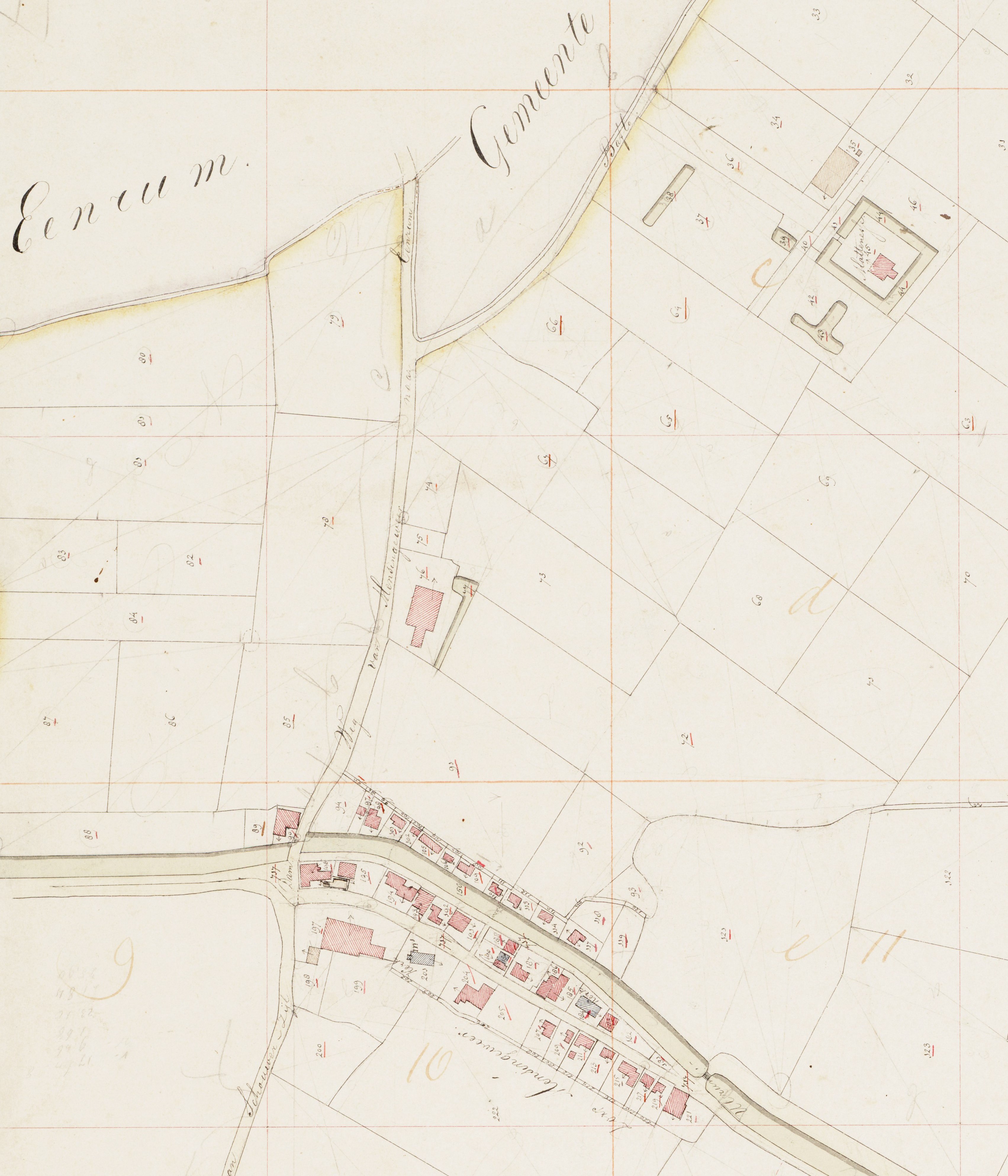
Nederlands: Uitsnede kadasterkaart gemeente Leens - den Hoorn (1832) met onder het dorp Mensingeweer en boven de borg Matenesse. |
| Date | |
| Source | Groninger Archieven - Beeldbank Groningen |
| Author | R.B. van Leggelo |
Schaal: 1:2500
Licensing
[edit]_-_R.B._van_Leggelo,_1832_(minuutplan)_-_Matenesse.jpg&action=edit§ion=2)
|
This work is in the public domain in its country of origin and other countries and areas where the copyright term is the author's life plus 100 years or fewer. | |
| This file has been identified as being free of known restrictions under copyright law, including all related and neighboring rights. | |
File history
Click on a date/time to view the file as it appeared at that time.
| Date/Time | Thumbnail | Dimensions | User | Comment | |
|---|---|---|---|---|---|
| current | 12:04, 24 June 2017 | | 3,406 × 3,971 (1.67 MB) | Martijn425 (talk | contribs) | User created page with UploadWizard |
You cannot overwrite this file.
File usage on Commons
There are no pages that use this file.
File usage on other wikis
The following other wikis use this file:
- Usage on nl.wikipedia.org
_-_R.B._van_Leggelo,_1832_(minuutplan)_-_Matenesse.jpg&oldid=698022451)