File:Ungarn BV042512105.jpg

Original file (1,584 × 1,127 pixels, file size: 255 KB, MIME type: image/jpeg)
Captions
Captions
Summary
[edit]| Title |
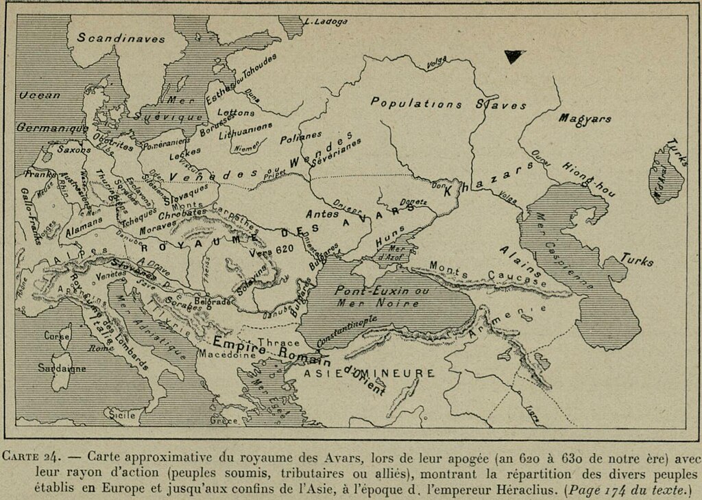
Carte approximative du royaume des Avars, lors de leur apogee (an 620 à 630 de notre ère) avec leur rayon d’action (peoples soumis, tributaires ou allies), montrant la repartition des divers peoples établis en Europe et jusqu’aux confins de l’Asie, à l’epoque de l’empereur Héraclius |
|||||||||||||||||||||||
| Description |
Deutsch: UngarnAwaren |
|||||||||||||||||||||||
| Date | ||||||||||||||||||||||||
| Source | Leibniz-Institut für Ost- und Südosteuropaforschung (IOS) GeoPortOst | |||||||||||||||||||||||
| Permission (Reusing this file) |
|
|||||||||||||||||||||||
| Geotemporal data | ||||||||||||||||||||||||
| Date depicted | from 620 until 630 | |||||||||||||||||||||||
| Map location | Ungarn | |||||||||||||||||||||||
| Map type | Geschichtskarte | |||||||||||||||||||||||
| Bounding box |
|
|||||||||||||||||||||||
| Georeferencing | ||||||||||||||||||||||||
| Bibliographic data | ||||||||||||||||||||||||
| Map sheet | 24 | |||||||||||||||||||||||
| Language | French | |||||||||||||||||||||||
| Archival data | ||||||||||||||||||||||||
| Collection |
|
|||||||||||||||||||||||
| Accession number |
BV042512105 |
|||||||||||||||||||||||

Licensing
[edit]
|
This work is in the public domain in its country of origin and other countries and areas where the copyright term is the author's life plus 70 years or fewer.
| |
| This file has been identified as being free of known restrictions under copyright law, including all related and neighboring rights. | |
File history
Click on a date/time to view the file as it appeared at that time.
| Date/Time | Thumbnail | Dimensions | User | Comment | |
|---|---|---|---|---|---|
| current | 22:41, 27 November 2023 | | 1,584 × 1,127 (255 KB) | Enyavar (talk | contribs) | Cropped 19 % horizontally, 16 % vertically using CropTool with precise mode. |
| 12:50, 14 February 2019 |  | 1,954 × 1,337 (310 KB) | Romcjg (talk | contribs) | pattypan 18.02 |
You cannot overwrite this file.
File usage on Commons
The following page uses this file: