File:United Kingdom general election, 2017 (Northern Ireland).svg
Jump to navigation
Jump to search

Size of this PNG preview of this SVG file: 736 × 600 pixels. Other resolutions: 295 × 240 pixels | 589 × 480 pixels | 942 × 768 pixels | 1,256 × 1,024 pixels | 2,513 × 2,048 pixels | 779 × 635 pixels.
Original file (SVG file, nominally 779 × 635 pixels, file size: 136 KB)
Captions
Captions
Add a one-line explanation of what this file represents
Summary[edit]
| Description |
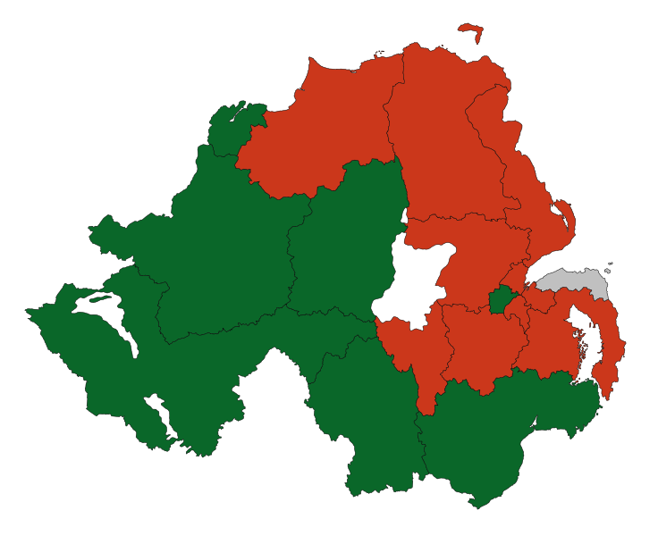
English: Results of the 2017 general election in the United Kingdom in Northern Ireland. Ultimately based upon data from the Boundary Commission. Made using Inkscape. Colours are as below: Democratic Unionist Party Sinn Féin Independent Deutsch: Ergebnisse der Unterhauswahlen 2010 im Vereinigten Königreich in den nordirischen Wahlkreisen:
Democratic Unionist Party Sinn Féin Unabhängige |
||
| Date | |||
| Source | Own work | ||
| Author | Furfur, Brythones | ||
| Permission (Reusing this file) |
I, the copyright holder of this work, hereby publish it under the following licenses:
This file is licensed under the Creative Commons Attribution-Share Alike 4.0 International license.
You may select the license of your choice. |
||
| SVG development | This map was created with Adobe Illustrator. |

.svg&action=edit§ion=1)
File history
Click on a date/time to view the file as it appeared at that time.
| Date/Time | Thumbnail | Dimensions | User | Comment | |
|---|---|---|---|---|---|
| current | 19:34, 18 June 2017 | | 779 × 635 (136 KB) | Renamed user OCfxJKu7j2 (talk | contribs) | Better quality |
| 22:55, 9 June 2017 |  | 779 × 635 (135 KB) | Furfur (talk | contribs) | =={{int:filedesc}}== {{Information |description={{en|1=Results of the 2017 general election in the United Kingdom in Northern Ireland. Ultimately based upon data from the Boundary Commission. Made using Inkscape. Colours are as below: {{legend|#c30|Dem... |
You cannot overwrite this file.
File usage on Commons
The following 2 pages use this file:
File usage on other wikis
The following other wikis use this file:
- Usage on de.wikipedia.org
- Usage on en.wikipedia.org
- Usage on fr.wikipedia.org
- Usage on pl.wikipedia.org
.svg&oldid=850105650)