File:Unterm Ratskopf 53 (Wernigerode).jpg
Jump to navigation
Jump to search

Size of this preview: 800 × 600 pixels. Other resolutions: 320 × 240 pixels | 640 × 480 pixels | 1,024 × 768 pixels | 1,280 × 960 pixels | 2,560 × 1,920 pixels | 4,320 × 3,240 pixels.
Original file (4,320 × 3,240 pixels, file size: 5.72 MB, MIME type: image/jpeg)
Captions
Captions
Add a one-line explanation of what this file represents
Summary[edit]
.jpg&action=edit§ion=1)
| Description |
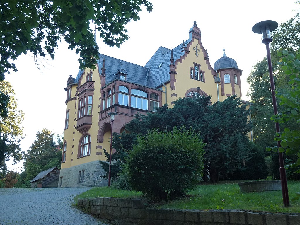
Deutsch: Villa Hendeß am Eisenberg in Wernigerode, zur Straße Unterm Ratskopf gehörend. Erbaut 1896-1897 vom Fabrikbesitzer Hugo Hendeß (Fabrik photographischer Papiere vorm. Dr. A. Kurz AG) nach Plänen des Berliner Architekten Hans Grisebach. Hendeß verstarb 1941, seine Witwe blieb, musste aber große Teile des Hauses verpachten. 1964 Verkauf an den Rat des Kreises Wernigerode. Bis 1990 Nutzung als Pionierhaus, 1991-2009 Kreisvolkshochschule, seit 2009 privatisiert und Sitz von Baufirmen. |
| Date | |
| Source | Own work |
| Author | Migebert |
| Camera location | | View this and other nearby images on: OpenStreetMap |
|---|
.jpg¶ms=051.831706_N_0010.770497_E_globe:Earth_type:camera_heading:240.00&language=en)
Licensing[edit]
.jpg&action=edit§ion=2)
I, the copyright holder of this work, hereby publish it under the following license:
This file is licensed under the Creative Commons Attribution-Share Alike 4.0 International license.
- You are free:
- to share – to copy, distribute and transmit the work
- to remix – to adapt the work
- Under the following conditions:
- attribution – You must give appropriate credit, provide a link to the license, and indicate if changes were made. You may do so in any reasonable manner, but not in any way that suggests the licensor endorses you or your use.
- share alike – If you remix, transform, or build upon the material, you must distribute your contributions under the same or compatible license as the original.
File history
Click on a date/time to view the file as it appeared at that time.
| Date/Time | Thumbnail | Dimensions | User | Comment | |
|---|---|---|---|---|---|
| current | 14:19, 29 September 2016 | | 4,320 × 3,240 (5.72 MB) | Migebert (talk | contribs) | User created page with UploadWizard |
You cannot overwrite this file.
File usage on Commons
There are no pages that use this file.
File usage on other wikis
The following other wikis use this file:
- Usage on de.wikipedia.org
.jpg&oldid=642972112)