File:V-11 memorial.JPG
Jump to navigation
Jump to search
Size of this preview: 401 × 599 pixels. Other resolutions: 160 × 240 pixels | 321 × 480 pixels | 514 × 768 pixels | 685 × 1,024 pixels | 1,371 × 2,048 pixels | 2,592 × 3,872 pixels.
Original file (2,592 × 3,872 pixels, file size: 2.45 MB, MIME type: image/jpeg)
Captions
Captions
Add a one-line explanation of what this file represents
Summary
[edit]
| Description |
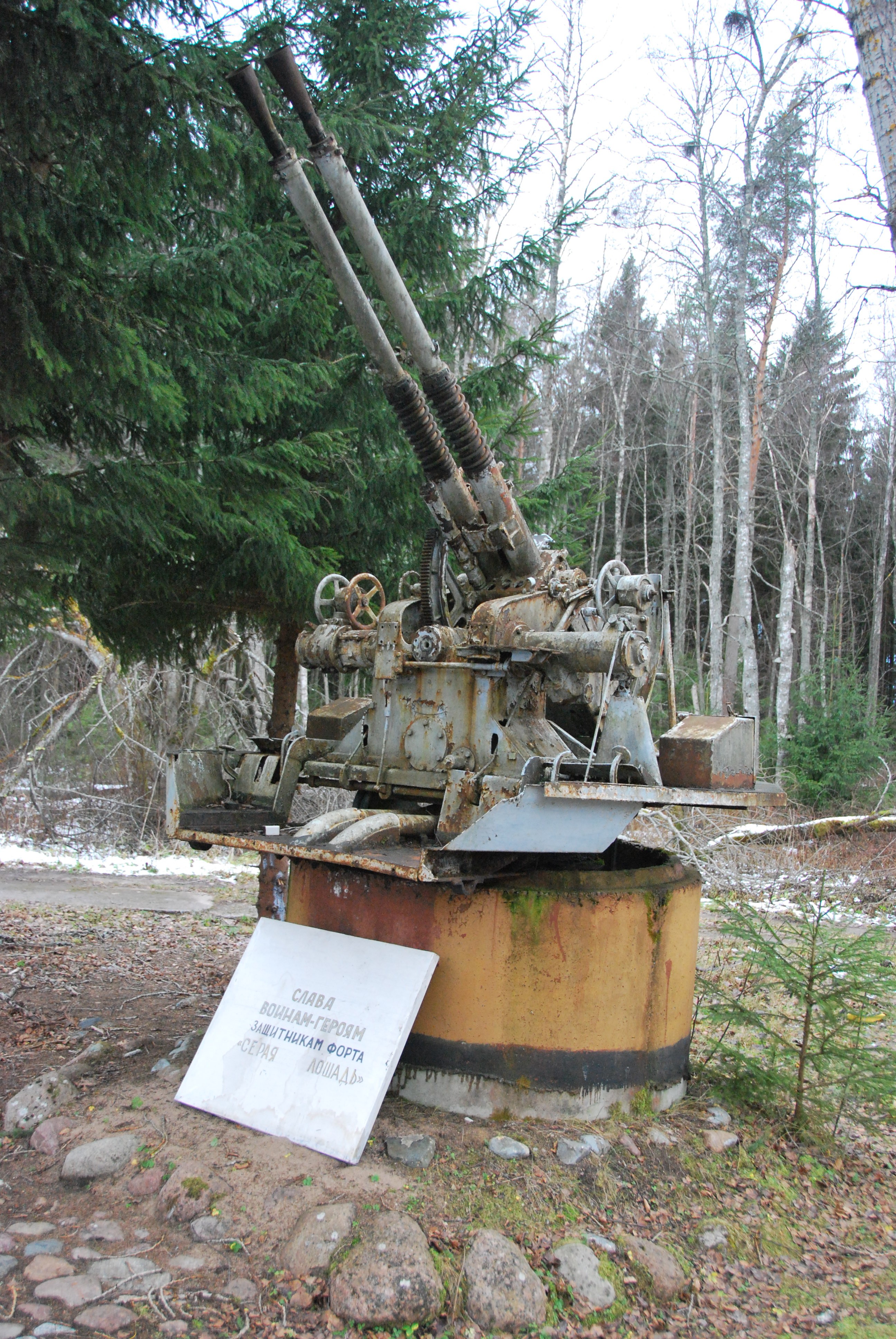
Русский: Спаренное 37-мм орудие В-11 - памятник защитникам форта Серая Лошадь
English: Twin 37 mm anti-aircraft autocannon V-11 - memorial to the defenders of Seraya Loshad' fort |
| Date | |
| Source | Own work |
| Author | One half 3544 |
| Openstreetmap entry | Link to Openstreetmap |
| Object location | | View this and other nearby images on: OpenStreetMap |
|---|
| Camera location | | View this and other nearby images on: OpenStreetMap |
|---|
Licensing
[edit]
| I, the copyright holder of this work, release this work into the public domain. This applies worldwide. In some countries this may not be legally possible; if so: I grant anyone the right to use this work for any purpose, without any conditions, unless such conditions are required by law. |
Данное орудие усилиями активистов форта Красная горка было спасено от вывоза мородерами на метал Власти вывезли его частично отреставрировали Теперь оно установлено на пьедестал рядом с мемориалом "Балтийцам" на шоссе Спб-Сосновый Бор у деревни Шепелево
File history
Click on a date/time to view the file as it appeared at that time.
| Date/Time | Thumbnail | Dimensions | User | Comment | |
|---|---|---|---|---|---|
| current | 16:48, 27 November 2010 | | 2,592 × 3,872 (2.45 MB) | One half 3544 (talk | contribs) | rotation |
| 16:43, 27 November 2010 |  | 3,872 × 2,592 (2.39 MB) | One half 3544 (talk | contribs) | {{Information |Description= {{ru|Спаренное 37-мм орудие В-11 - памятник защитникам форта Серая Лошадь}} {{en|Twin 37 mm anti-aircraft autocannon V-11 - memorial to the defenders of Seraya Loshad' fort}} |
You cannot overwrite this file.
File usage on Commons
The following 2 pages use this file:
File usage on other wikis
The following other wikis use this file:
- Usage on bg.wikipedia.org
- Usage on de.wikipedia.org
- Usage on en.wikipedia.org
- Usage on es.wikipedia.org
- Usage on fi.wikipedia.org
- Usage on it.wikipedia.org
- Usage on pt.wikipedia.org
- Usage on ru.wikipedia.org
- Usage on vi.wikipedia.org
- Usage on www.wikidata.org
- Usage on zh.wikipedia.org