File:VOC Octrooigebied 2.jpg
Jump to navigation
Jump to search

Size of this preview: 800 × 527 pixels. Other resolutions: 320 × 211 pixels | 640 × 422 pixels | 1,024 × 675 pixels | 1,280 × 844 pixels | 3,000 × 1,978 pixels.
Original file (3,000 × 1,978 pixels, file size: 663 KB, MIME type: image/jpeg)
Captions
Captions
Add a one-line explanation of what this file represents
Summary[edit]
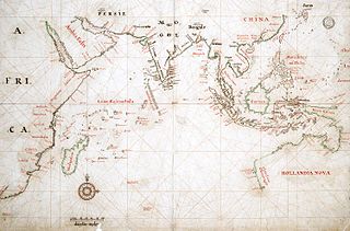
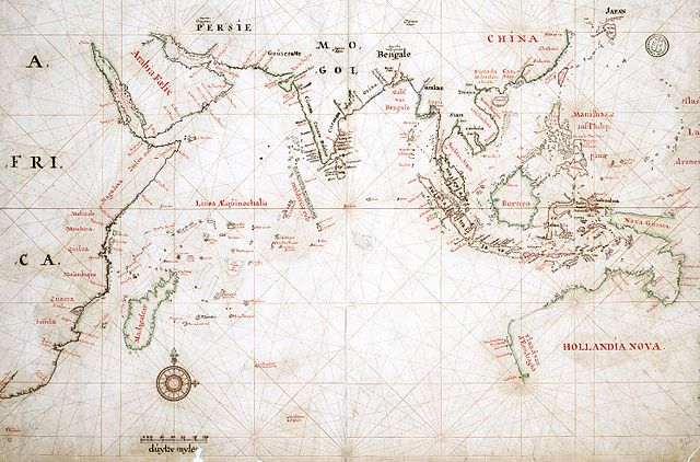
| Description | Map of the actual trade zone (octrooigebied) of the VOC, between Cape of Good Hope (South Africa) and Japan; c. 1665. The VOC establishments are marked with yellow dots and names in black. |
| Date | |
| Source | TANAP |
| Author |
Licensing[edit]
|
This work is in the public domain in its country of origin and other countries and areas where the copyright term is the author's life plus 100 years or fewer. | |
| This file has been identified as being free of known restrictions under copyright law, including all related and neighboring rights. | |
File history
Click on a date/time to view the file as it appeared at that time.
| Date/Time | Thumbnail | Dimensions | User | Comment | |
|---|---|---|---|---|---|
| current | 10:33, 3 May 2008 | | 3,000 × 1,978 (663 KB) | BoH (talk | contribs) | {{Information |Description=Map of the actual trade zone (octrooigebied) of the VOC, between Cape of Good Hope (South Africa) and Japan; c. 1665. The VOC establishments are marked with yellow dots and names in black. |Source=[http://www.tanap.net/content/v |
You cannot overwrite this file.
File usage on Commons
There are no pages that use this file.
File usage on other wikis
The following other wikis use this file:
- Usage on de.wikipedia.org
- Usage on fr.wikipedia.org
- Usage on fy.wikipedia.org
- Usage on lt.wikipedia.org
- Usage on nl.wikipedia.org