File:Via Popilia.jpg
Jump to navigation
Jump to search
Size of this preview: 649 × 599 pixels. Other resolutions: 260 × 240 pixels | 520 × 480 pixels | 832 × 768 pixels | 1,212 × 1,119 pixels.
Original file (1,212 × 1,119 pixels, file size: 433 KB, MIME type: image/jpeg)
Captions
Captions
Add a one-line explanation of what this file represents
| Description |
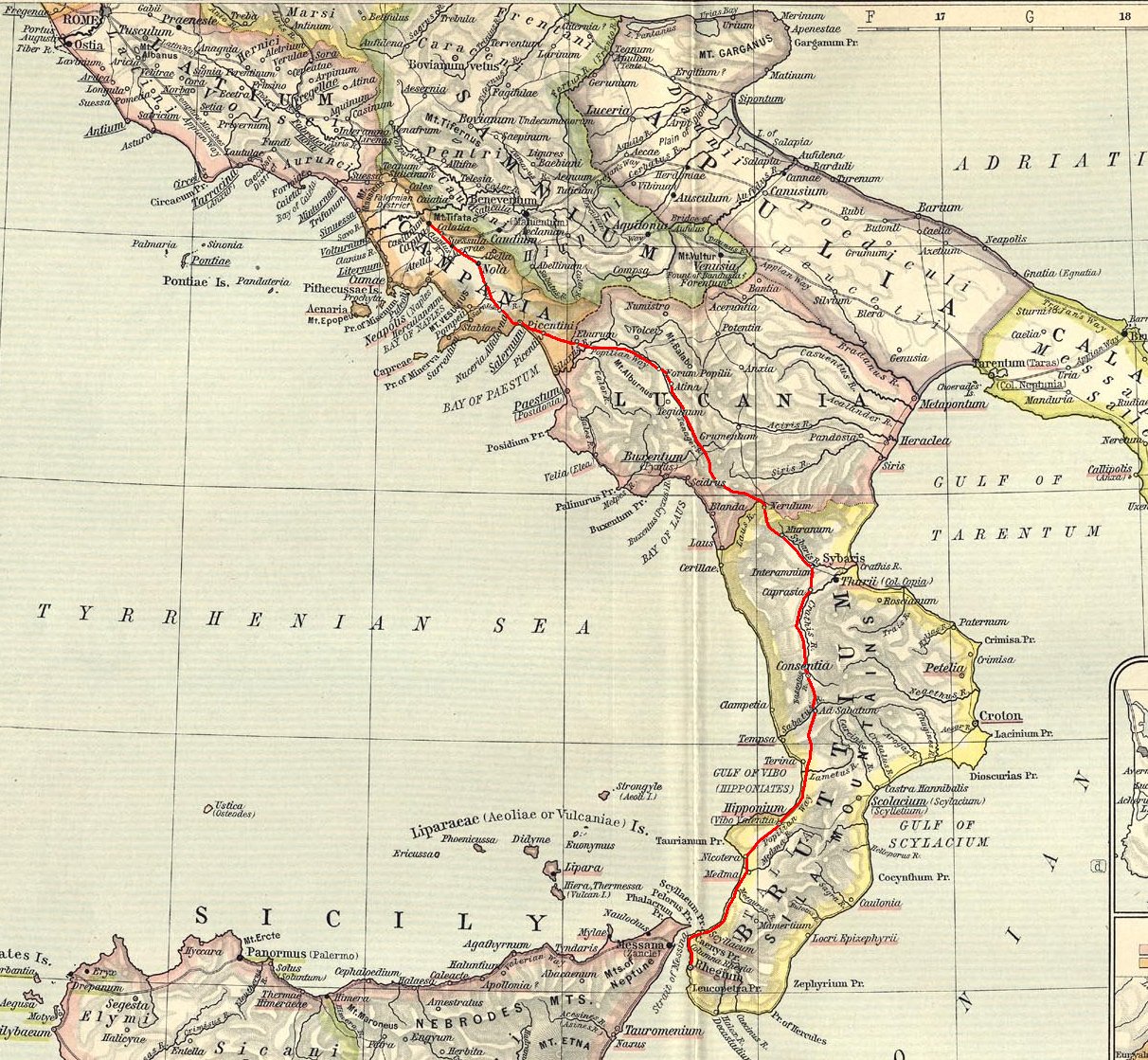
English: Ancient roman Capua-Rhegium (Popilia) road (from a William R. Shepherd 1923 map) highlited in red color. Italiano: In colore rosso evidenziata la via Capua-Rhegium (Popilia) (su mappa di William R. Shepherd, 1923). |
||||
| Date | |||||
| Source |
Based on a map from "Historical Atlas" by William R. Shepherd, New York, Henry Holt and Company, 1923 now in Public Domain. Reference: Reference Map of Ancient Italy, Southern Part Courtesy of the University of Texas Libraries, The University of Texas at Austin. [1] |
||||
| Author | EH101 | ||||
| Permission (Reusing this file) |
|
||||
![[1]](http://www.lib.utexas.edu/maps/historical/shepherd/italy_ancient_south.jpg)
File history
Click on a date/time to view the file as it appeared at that time.
| Date/Time | Thumbnail | Dimensions | User | Comment | |
|---|---|---|---|---|---|
| current | 15:25, 11 May 2012 | | 1,212 × 1,119 (433 KB) | EH101 (talk | contribs) | {{Information |Description={{en|Ancient roman Capua-Rhegium (Popilia) road (from a William R. Shepherd 1923 map) highlited in red color.}} {{it|In colore rosso evidenziata la via Capua-Rhegium (Popilia) (su mappa di William R... |
You cannot overwrite this file.
File usage on Commons
There are no pages that use this file.
File usage on other wikis
The following other wikis use this file:
- Usage on it.wikipedia.org
- Usage on ro.wikipedia.org