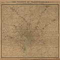
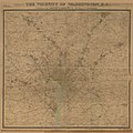
File:Vicinity of Washington DC by Griffith Hopkins, 1894.jpg

Original file (18,600 × 18,600 pixels, file size: 46.48 MB, MIME type: image/jpeg)
Captions
Captions
Summary[edit]
| Warning | The original file is very high-resolution. It might not load properly or could cause your browser to freeze when opened at full size. |
|---|
| Title |
The vicinity of Washington, D.C. |
|||||||||||||||||||||||||
| DescriptionVicinity of Washington DC by Griffith Hopkins, 1894.jpg |
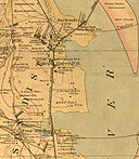
- Partial cadastral map showing buildings and householders' names beyond city limits. - Relief shown by contours. - Also shows radial distances from White House. - "Entered according to Act of Congress, in the year 1894, by G.M. Hopkins ..." - Stephenson. Cartography of northern Virginia, pl. 95-98 - Includes note. - Available also through the Library of Congress Web site as a raster image. - LC copies darkened, assembled, resectioned to 6 sheets, hand col. to emphasize boundaries, and mounted on cloth backing. Copy 1 also rubber-stamped and annotated in red ink at lower right: No. 7 Dist. of Columbia. Some sheets of copy 2 not hand col. |
|||||||||||||||||||||||||
| Date | ||||||||||||||||||||||||||
| Source | https://www.loc.gov/item/88693364/ | |||||||||||||||||||||||||
| Creator |
creator QS:P170,Q64021456 |
|||||||||||||||||||||||||
| Permission (Reusing this file) |
|
|||||||||||||||||||||||||
| Geotemporal data | ||||||||||||||||||||||||||
| Bounding box |
|
|||||||||||||||||||||||||
| Georeferencing | View the georeferenced map in the Wikimaps Warper | |||||||||||||||||||||||||
| Place of publication | Philadelphia | |||||||||||||||||||||||||
| Archival data | ||||||||||||||||||||||||||
| Dimensions | 1 map on 6 sheets : col. ; 135 x 150 cm., sheets 56 x 79 cm. or smaller. | |||||||||||||||||||||||||
| Other versions |
|
|||||||||||||||||||||||||
File history
Click on a date/time to view the file as it appeared at that time.
| Date/Time | Thumbnail | Dimensions | User | Comment | |
|---|---|---|---|---|---|
| current | 19:43, 30 April 2022 |  | 18,600 × 18,600 (46.48 MB) | Scewing (talk | contribs) | Higher resolution |
| 19:19, 30 April 2022 |  | 4,650 × 4,650 (4.38 MB) | Scewing (talk | contribs) | {{Map |title =The vicinity of Washington, D.C. |description =- Partial cadastral map showing buildings and householders' names beyond city limits. - Relief shown by contours. - Also shows radial distances from White House. - "Entered according to Act of Congress, in the year 1894, by G.M. Hopkins ..." - Stephenson. Cartography of northern Virginia, pl. 95-98 - Includes note. - Available also through the Library of Congress Web site as a raster image. - LC copies da... |
You cannot overwrite this file.
File usage on Commons
The following page uses this file:
Metadata
This file contains additional information such as Exif metadata which may have been added by the digital camera, scanner, or software program used to create or digitize it. If the file has been modified from its original state, some details such as the timestamp may not fully reflect those of the original file. The timestamp is only as accurate as the clock in the camera, and it may be completely wrong.
| Width | 18,600 px |
|---|---|
| Height | 18,600 px |
| Bits per component |
|
| Compression scheme | Uncompressed |
| Pixel composition | RGB |
| Image data location | 26,574 |
| Orientation | Normal |
| Number of components | 3 |
| Number of rows per strip | 18,600 |
| Bytes per compressed strip | 1,037,880,000 |
| Horizontal resolution | 300 dpi |
| Vertical resolution | 300 dpi |
| Data arrangement | chunky format |
| Software used | Adobe Photoshop CS4 Windows |
| File change date and time | 14:31, 31 July 2012 |


