File:View across the Arminghall Henge - geograph.org.uk - 1391552.jpg
Jump to navigation
Jump to search
No higher resolution available.
View_across_the_Arminghall_Henge_-_geograph.org.uk_-_1391552.jpg (640 × 480 pixels, file size: 104 KB, MIME type: image/jpeg)
Captions
Captions
Add a one-line explanation of what this file represents
Summary[edit]
| Description |
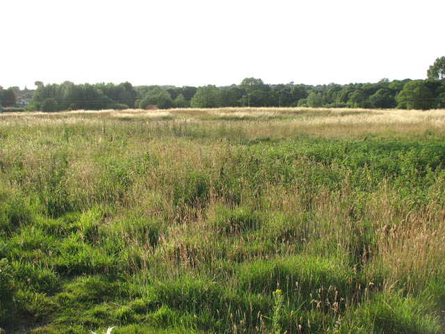
English: View across the Arminghall Henge Its outline is still visible in low light. In 1929 a prehistoric timber circle and henge monument site was discovered 1½ miles (2½ km) northwest of Arminghall village by Gilbert Insall VC who had been taking aerial photographs of the area in search of new archaeological sites. Whilst flying at around 2,000 feet (600 m) he noticed cropmarks of a circular enclosure made of two concentric rings with a horseshoe of eight pit-like markings within it. The entire site was around 75 m in diameter. The site was visited a week later by O.G.S. Crawford, who pronounced it to be the Norwich Woodhenge but it was not until 1935 that it was first excavated, by Grahame Clark. His work established that two circular rings were ditches, the outer one 1.5 m deep and the inner one 2.3 m deep, with indications of a bank that once stood between them. The pits in the middle were postholes for timbers that would have been almost 1 m in diameter. The site dates to the Neolithic, with a radiocarbon date of 3650-2650 Cal BC (4440±150) from charcoal from a post-pit. The henge is orientated on the mid-winter sunset, which, when viewed from the lication, sets down the slope of nearby high ground, Chapel Hill. |
| Date | |
| Source | From geograph.org.uk |
| Author | Evelyn Simak |
| Attribution (required by the license) | Evelyn Simak / View across the Arminghall Henge / |
| Camera location | | View this and other nearby images on: OpenStreetMap |
|---|
_heading:270.00&language=en)
| Object location | | View this and other nearby images on: OpenStreetMap |
|---|
_heading:270.00&language=en)
Licensing[edit]

|
This image was taken from the Geograph project collection. See this photograph's page on the Geograph website for the photographer's contact details. The copyright on this image is owned by Evelyn Simak and is licensed for reuse under the Creative Commons Attribution-ShareAlike 2.0 license.
|
This file is licensed under the Creative Commons Attribution-Share Alike 2.0 Generic license.
Attribution: Evelyn Simak
- You are free:
- to share – to copy, distribute and transmit the work
- to remix – to adapt the work
- Under the following conditions:
- attribution – You must give appropriate credit, provide a link to the license, and indicate if changes were made. You may do so in any reasonable manner, but not in any way that suggests the licensor endorses you or your use.
- share alike – If you remix, transform, or build upon the material, you must distribute your contributions under the same or compatible license as the original.
File history
Click on a date/time to view the file as it appeared at that time.
| Date/Time | Thumbnail | Dimensions | User | Comment | |
|---|---|---|---|---|---|
| current | 23:40, 28 February 2011 | | 640 × 480 (104 KB) | GeographBot (talk | contribs) | == {{int:filedesc}} == {{Information |description={{en|1=View across the Arminghall Henge Its outline is still visible in low light. In 1929 a prehistoric timber circle and henge monument site was discovered 1½ miles (2½ km) northwest of Arminghall vill |
You cannot overwrite this file.
File usage on Commons
There are no pages that use this file.
File usage on other wikis
The following other wikis use this file:
- Usage on de.wikipedia.org