File:Vileyka district map hydragraphic.svg
Jump to navigation
Jump to search

Size of this PNG preview of this SVG file: 800 × 566 pixels. Other resolutions: 320 × 226 pixels | 640 × 453 pixels | 1,024 × 724 pixels | 1,280 × 905 pixels | 2,560 × 1,810 pixels | 1,123 × 794 pixels.
Original file (SVG file, nominally 1,123 × 794 pixels, file size: 2.38 MB)
Captions
Captions
Add a one-line explanation of what this file represents
Summary[edit]
| Description |
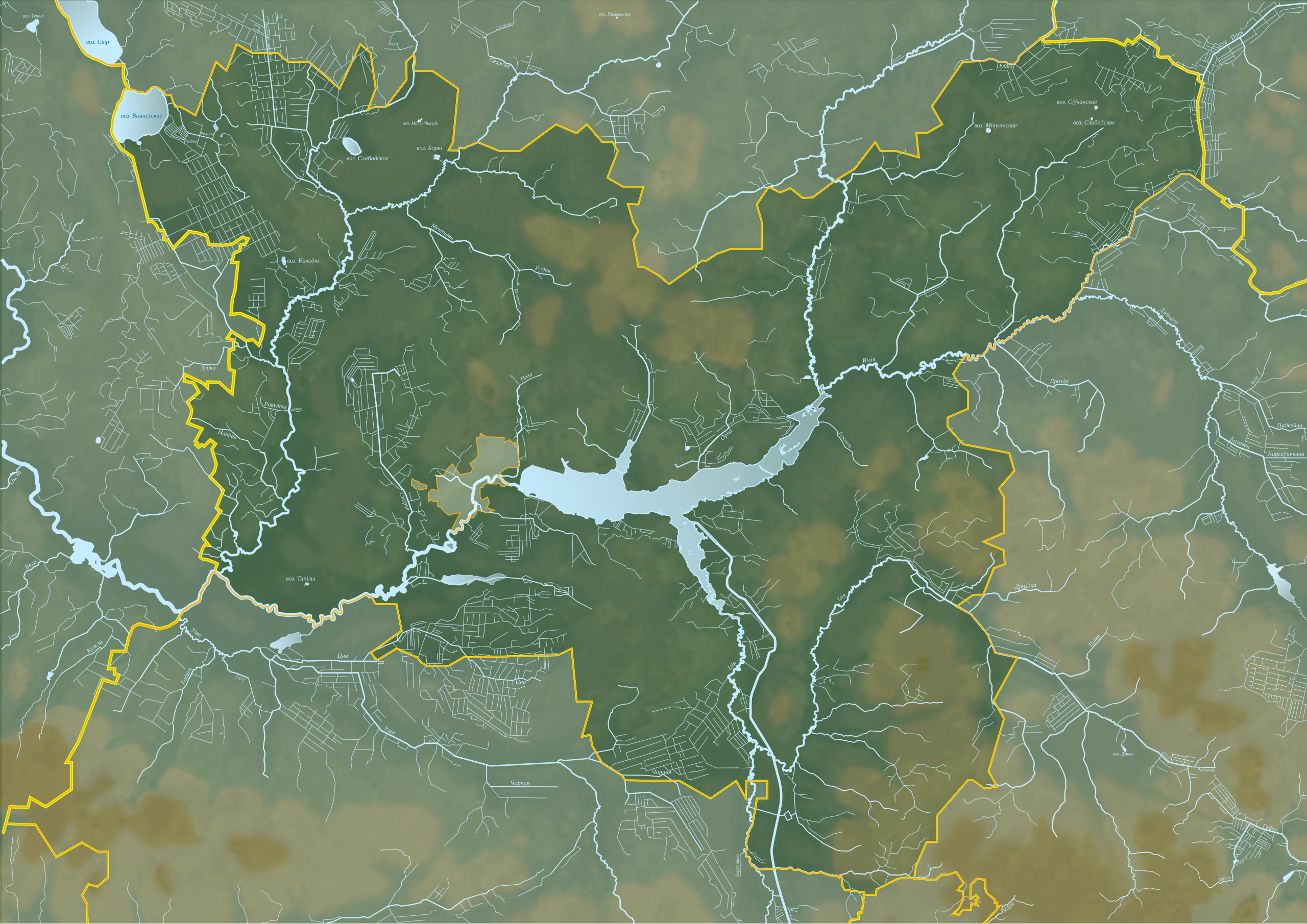
Беларуская: Гідраграфія Вілейскага раёна
English: Hydrography Vileyka district
Русский: Гидрография Вилейского района
Polski: Dzielnica hydrografii Vileyka
Пазіцыйная карта Вілейскага раёна Мінскай вобласці. Цыліндрычная роўнавугольная праекцыя з каардынатамі краёў:
|
| Date | |
| Source |
Own work на падставе OpenStreetMap using Maperitive This W3C-unspecified vector image was created with Inkscape . |
| Author | Dehty |
| Other versions |
 |
Licensing[edit]
I, the copyright holder of this work, hereby publish it under the following license:
This file is licensed under the Creative Commons Attribution-Share Alike 4.0 International license.
- You are free:
- to share – to copy, distribute and transmit the work
- to remix – to adapt the work
- Under the following conditions:
- attribution – You must give appropriate credit, provide a link to the license, and indicate if changes were made. You may do so in any reasonable manner, but not in any way that suggests the licensor endorses you or your use.
- share alike – If you remix, transform, or build upon the material, you must distribute your contributions under the same or compatible license as the original.
File history
Click on a date/time to view the file as it appeared at that time.
| Date/Time | Thumbnail | Dimensions | User | Comment | |
|---|---|---|---|---|---|
| current | 13:03, 16 May 2018 | | 1,123 × 794 (2.38 MB) | Dehty (talk | contribs) | User created page with UploadWizard |
You cannot overwrite this file.
File usage on Commons
The following page uses this file:
File usage on other wikis
The following other wikis use this file:
- Usage on be.wikipedia.org
- Вілейскі раён
- Ілія
- Бачылаўка
- Белавароціца (рака)
- Вужык
- Жучок
- Кабылянка (рака)
- Каменка (басейн Нёмана)
- Канатопка
- Алхімаўка
- Наква
- Орпа
- Жучка
- Смердзія
- Дзвонка
- Сластаўка
- Спорня
- Ментынь
- Спягліца (рака)
- Пела
- Выпрата
- Зуста
- Ганутка (прыток Нарачы)
- Груздзеніца
- Панурка
- Шаблон:На карце/Беларусь Мінская вобласць Вілейскі раён
- Сярчыстая
- Шабеніха
- Рудня (прыток Ментыні)
- Юнцаўшчына (ручай)
- Usage on ru.wikipedia.org