File:Vivekananda rock memorial Kanyakumari-5.jpg
Jump to navigation
Jump to search

Size of this preview: 800 × 473 pixels. Other resolutions: 320 × 189 pixels | 640 × 378 pixels | 1,280 × 756 pixels.
Original file (1,280 × 756 pixels, file size: 202 KB, MIME type: image/jpeg)
Captions
Captions
Add a one-line explanation of what this file represents
Summary[edit]
| Description |
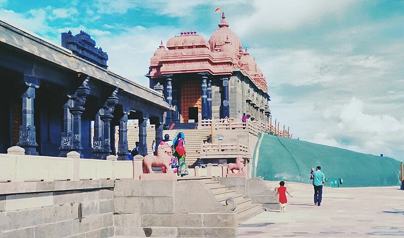
Deutsch: Vivekananda-Felsendenkmal, Kanyakumari, letztes Südland Indiens. Es wurde zu Ehren von Swami Vivekananda (1863-1902) erbaut, der auf dem Felsen die Erleuchtung erlangt haben soll.
English: Vivekananda Rock Memorial, Kanyakumari, last south land of India. It was built in honour of Swami Vivekananda (1863-1902), who is said to have attained enlightenment on the rock. |
| Date | |
| Source | Own work |
| Author | Bharatkaistha |
| Camera location | | View this and other nearby images on: OpenStreetMap |
|---|
Licensing[edit]
I, the copyright holder of this work, hereby publish it under the following license:
This file is licensed under the Creative Commons Attribution-Share Alike 4.0 International license.
- You are free:
- to share – to copy, distribute and transmit the work
- to remix – to adapt the work
- Under the following conditions:
- attribution – You must give appropriate credit, provide a link to the license, and indicate if changes were made. You may do so in any reasonable manner, but not in any way that suggests the licensor endorses you or your use.
- share alike – If you remix, transform, or build upon the material, you must distribute your contributions under the same or compatible license as the original.
| Annotations | This image is annotated: View the annotations at Commons |
File history
Click on a date/time to view the file as it appeared at that time.
| Date/Time | Thumbnail | Dimensions | User | Comment | |
|---|---|---|---|---|---|
| current | 16:01, 26 June 2016 | | 1,280 × 756 (202 KB) | Bharatkaistha (talk | contribs) | User created page with UploadWizard |
You cannot overwrite this file.
File usage on Commons
There are no pages that use this file.