File:Water Lines Laid Across Lake Bridge on Skeet Club Road Project in High Point - 43460995835.jpg

Original file (5,184 × 3,456 pixels, file size: 3.75 MB, MIME type: image/jpeg)
Captions
Captions
Summary[edit]
| Description |
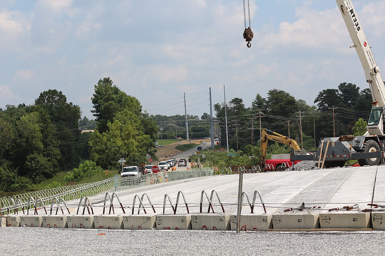
English: 8/30/2018 HIGH POINT — Work is moving forward this month on an N.C. Department of Transportation project to widen Skeet Club Road in High Point with contract crews progressing in the following areas: Contract crews have recently completed the following:
•Grading and pipe work are continuing along the entire length of the 3.4-mile project, •Temporary water and sewer lines have been laid across the lake bridge, and •Erosion control devices are being installed. “NCDOT and APAC Atlantic have agreed to an intermediate completion date to get the section of Skeet Club Road between N.C. 68 and Barrow Road in to the four-lane pattern by November of 2019,” said Resident Engineer Paul Ingram. NCDOT is also pursuing completion of the project by the end of the calendar year 2020. “This project will ultimately provide a wider, safer road and we appreciate ongoing public support as we work with our contractor to accomplish that goal for drivers coming to and through High Point,” said Division Engineer Mike Mills. Upcoming work requiring intermittent slow-downs and lane shifts include: •Pipe installations on Kendale Road (with the coming weeks), •Temporary water and sewer line work and Colonial Pipeline bridge work at Oak Hollow, •Lake (rescheduled due to weather until October); •Grading and paving for the Waterview Road relocation (September), and •Mowing will be scheduled for every two weeks as weather allows. The purpose of this project is to widen Skeet Club Road between N.C. 68 and Johnson Street to a multi-lane divided highway, including better accessibility for pedestrians. The project began in spring of 2015. NCDOT and the contractor agreed to pursue completion of the project by the end of 2020. Transportation officials advise drivers to watch signs for construction information, stay alert and obey the posted speed limit. For real-time travel information, visit DriveNC.gov or follow NCDOT on Twitter. |
| Date | |
| Source | https://www.flickr.com/photos/39320593@N03/43460995835/ |
| Author | NCDOTcommunications |
Licensing[edit]
- You are free:
- to share – to copy, distribute and transmit the work
- to remix – to adapt the work
- Under the following conditions:
- attribution – You must give appropriate credit, provide a link to the license, and indicate if changes were made. You may do so in any reasonable manner, but not in any way that suggests the licensor endorses you or your use.
| This image was originally posted to Flickr by NCDOTcommunications at https://flickr.com/photos/39320593@N03/43460995835. It was reviewed on 13 May 2021 by FlickreviewR 2 and was confirmed to be licensed under the terms of the cc-by-2.0. |
File history
Click on a date/time to view the file as it appeared at that time.
| Date/Time | Thumbnail | Dimensions | User | Comment | |
|---|---|---|---|---|---|
| current | 14:08, 13 May 2021 | | 5,184 × 3,456 (3.75 MB) | Ser Amantio di Nicolao (talk | contribs) | Uploaded a work by NCDOTcommunications from https://www.flickr.com/photos/39320593@N03/43460995835/ with UploadWizard |
You cannot overwrite this file.
File usage on Commons
There are no pages that use this file.