File:Waterfowl on Branston Water Park - geograph.org.uk - 64205.jpg
Jump to navigation
Jump to search
No higher resolution available.
Waterfowl_on_Branston_Water_Park_-_geograph.org.uk_-_64205.jpg (640 × 480 pixels, file size: 61 KB, MIME type: image/jpeg)
Captions
Captions
Add a one-line explanation of what this file represents
Summary[edit]
| Description |
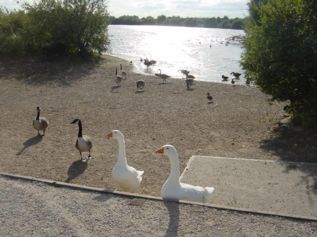
English: Waterfowl on Branston Water Park. Branston Water Park is situated between the Trent and Mersey Canal and the A38 road just SW of Burton. The area was first quarried for aggregates during the 1930's. The quarry was then functional up until the 1950's when it started to become too costly to continue pumping out the water, since then the quarry has gradually filled up with a natural supply of water as the water table has gradually risen up to today's present level. In 1989 the council started to make the site into an area suitable for the public to use for recreation. The Water Park has a number of different public users apart from tourists and bird watchers (the park has a naturally growing set of reed beds which are quite rare to Staffordshire). The clubs at present that use the water are the model boat club, fishermen and wind surfers |
| Date | |
| Source | From geograph.org.uk |
| Author | Sue Adair |
| Attribution (required by the license) | Sue Adair / Waterfowl on Branston Water Park / |
| Object location | | View this and other nearby images on: OpenStreetMap |
|---|
_&language=en)
Licensing[edit]

|
This image was taken from the Geograph project collection. See this photograph's page on the Geograph website for the photographer's contact details. The copyright on this image is owned by Sue Adair and is licensed for reuse under the Creative Commons Attribution-ShareAlike 2.0 license.
|
This file is licensed under the Creative Commons Attribution-Share Alike 2.0 Generic license.
Attribution: Sue Adair
- You are free:
- to share – to copy, distribute and transmit the work
- to remix – to adapt the work
- Under the following conditions:
- attribution – You must give appropriate credit, provide a link to the license, and indicate if changes were made. You may do so in any reasonable manner, but not in any way that suggests the licensor endorses you or your use.
- share alike – If you remix, transform, or build upon the material, you must distribute your contributions under the same or compatible license as the original.
File history
Click on a date/time to view the file as it appeared at that time.
| Date/Time | Thumbnail | Dimensions | User | Comment | |
|---|---|---|---|---|---|
| current | 20:39, 30 January 2010 | | 640 × 480 (61 KB) | GeographBot (talk | contribs) | == {{int:filedesc}} == {{Information |description={{en|1=Waterfowl on Branston Water Park. Branston Water Park is situated between the Trent and Mersey Canal and the A38 road just SW of Burton. The area was first quarried for aggregates during the 1930's. |
You cannot overwrite this file.
File usage on Commons
There are no pages that use this file.