File:Welcome to Saint Croix Island International Historic Site! Let's explore the park's interpretive trail. From here, it is 330 (1bfeecb2-155d-451f-67a4-b7637fa99219).JPG
Jump to navigation
Jump to search
Size of this preview: 800 × 600 pixels. Other resolutions: 320 × 240 pixels | 640 × 480 pixels | 1,024 × 768 pixels | 1,280 × 960 pixels | 2,048 × 1,536 pixels.
Original file (2,048 × 1,536 pixels, file size: 1.5 MB, MIME type: image/jpeg)
Captions
Captions
Add a one-line explanation of what this file represents

|
The categories of this image need checking. You can do so here.
|
.JPG&action=edit&withJS=MediaWiki:Catcheck.js)
Summary[edit]
.JPG&action=edit§ion=1)
| English: Photo 1 | ||||
|---|---|---|---|---|
| Photographer |
English: NPS |
|||
| Title |
English: Photo 1 |
|||
| Publisher |
English: U.S. National Park Service |
|||
| Description |
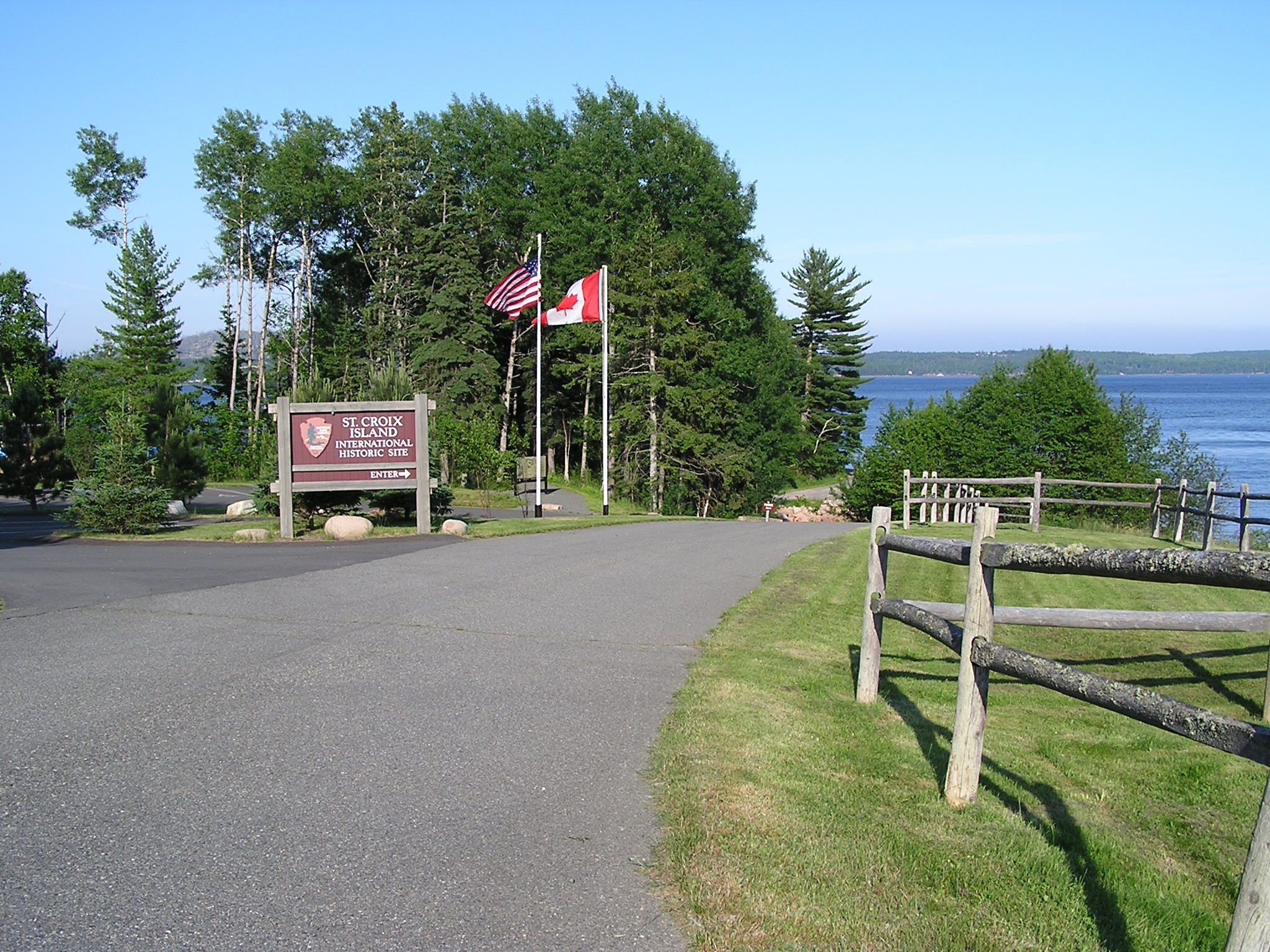
English: A road leads to an ocean view with tall trees. On the right of the road is a grassy area with a wood fence. On the left are flag poles, one with the United States flag and one with the Canadian flag. The flag poles are next to a large brown, illegible sign with the National Parks arrowhead logo. Welcome to Saint Croix Island International Historic Site! Let's explore the park's interpretive trail. From here, it is 330 feet (101 m) to the Interpretive Shelter. It is 385 feet (117 m) to the stairs to the beach and boat ramp.
|
|||
| Depicted place |
English: Saint Croix Island International Historic Site, Washington County, Maine |
|||
| Date | Taken on 16 July 2010 | |||
| Accession number | ||||
| Source |
English: NPGallery |
|||
| Permission (Reusing this file) |
|
|||
| NPS Unit Code | SACR | |||
| Album(s) | English: Self-guided Interpretive Trail |
|||
File history
Click on a date/time to view the file as it appeared at that time.
| Date/Time | Thumbnail | Dimensions | User | Comment | |
|---|---|---|---|---|---|
| current | 21:09, 10 May 2024 | | 2,048 × 1,536 (1.5 MB) | BMacZeroBot (talk | contribs) | Batch upload (Commons:Batch uploading/NPGallery) |
You cannot overwrite this file.
File usage on Commons
The following page uses this file:
.JPG)
.JPG&oldid=875687540)