File:Westerkwartier 1675-1700.jpg
Jump to navigation
Jump to search

Size of this preview: 748 × 600 pixels. Other resolutions: 299 × 240 pixels | 599 × 480 pixels | 958 × 768 pixels | 1,277 × 1,024 pixels | 2,555 × 2,048 pixels | 7,026 × 5,633 pixels.
Original file (7,026 × 5,633 pixels, file size: 9.62 MB, MIME type: image/jpeg)
Captions
Captions
Add a one-line explanation of what this file represents
Summary
[edit]
| Description |
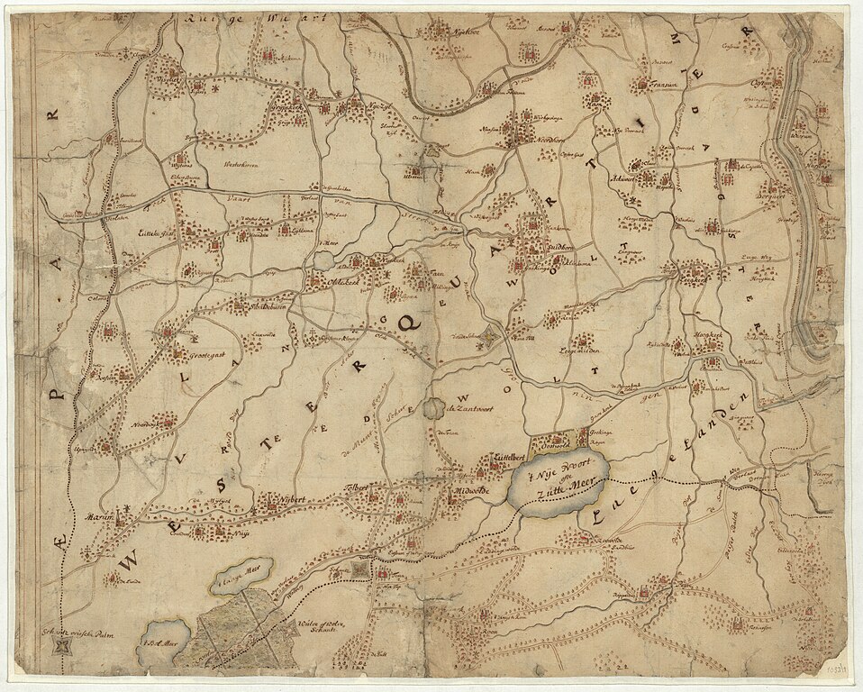
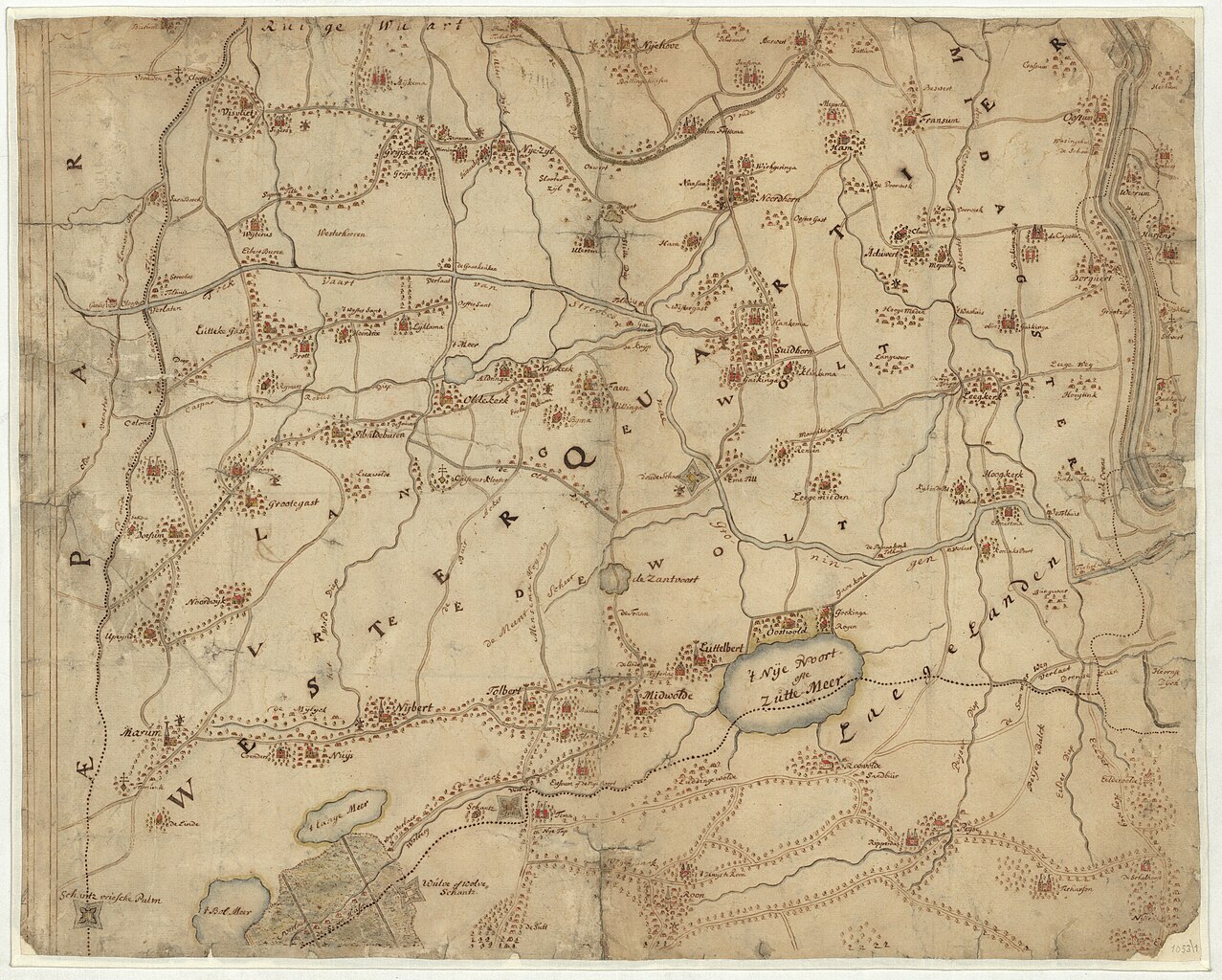
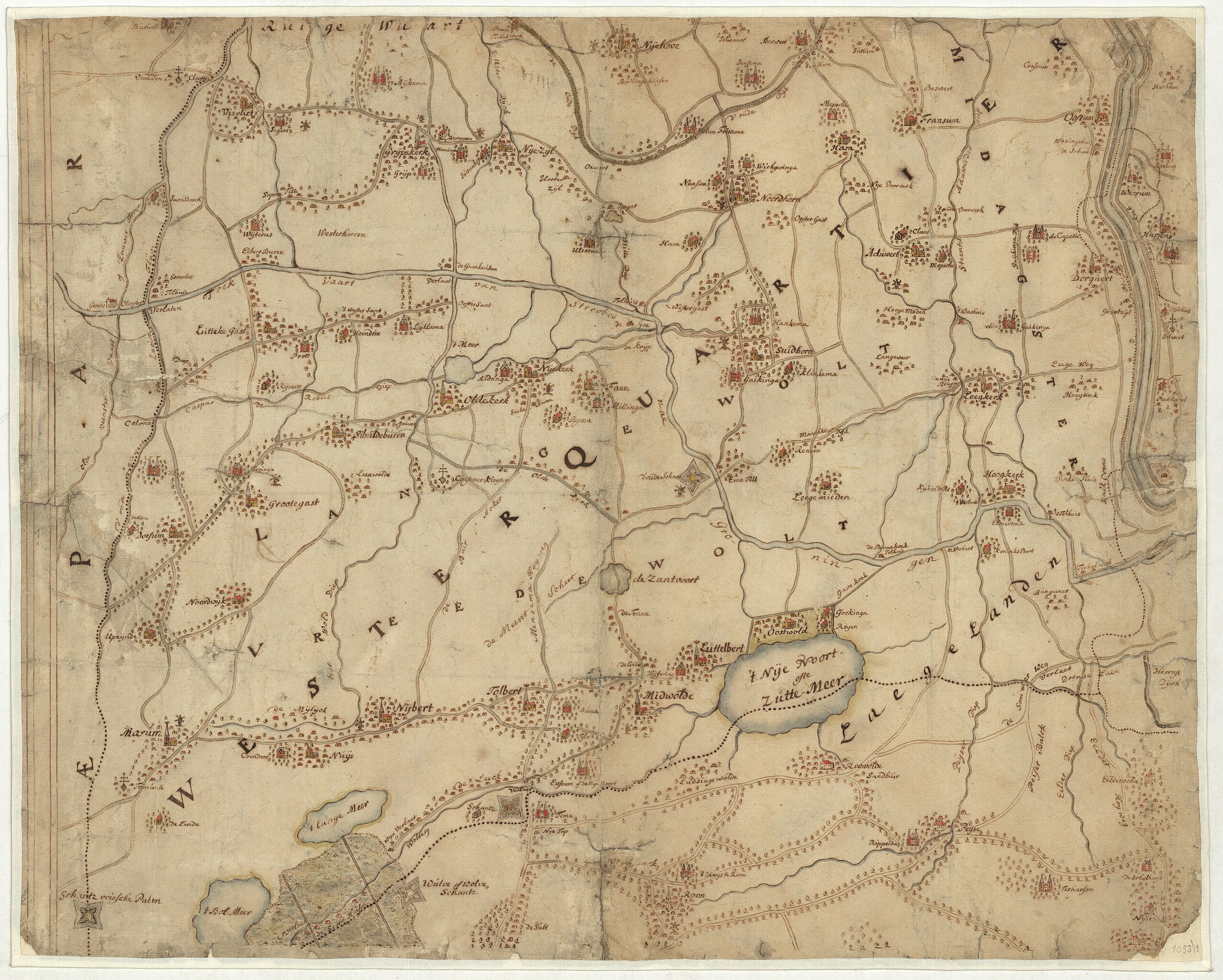
Nederlands: Kaart met een deel van het Westerkwartier in Groningen met aangrenzende gebieden in Drenthe. Onbekende maker en herkomst. Gezien de rand aan linkerzijde waarschijnlijk onderdeel van een grote kaart geweest.
Onderdeel van archieftoegang 817 Verzameling kaarten, prenten en tekeningen (RAG), 1500 - 1999. |
| Date | between circa 1675 and circa 1700 |
| Source | Beeldbank Groningen |
| Author | Unknown author |
Licensing
[edit]
|
This work is in the public domain in its country of origin and other countries and areas where the copyright term is the author's life plus 70 years or fewer. This work is in the public domain in the United States because it was published (or registered with the U.S. Copyright Office) before January 1, 1929. | |
| This file has been identified as being free of known restrictions under copyright law, including all related and neighboring rights. | |
File history
Click on a date/time to view the file as it appeared at that time.
| Date/Time | Thumbnail | Dimensions | User | Comment | |
|---|---|---|---|---|---|
| current | 12:24, 12 December 2020 | | 7,026 × 5,633 (9.62 MB) | Hardscarf (talk | contribs) | Uploaded a work by unknown from [https://www.beeldbankgroningen.nl/beelden/detail/7cb7c136-8c16-43a7-d010-92723685be45/media/f4f8d94e-f209-3d5d-c9e8-2086e3972f51 Beeldbank Groningen] with UploadWizard |
You cannot overwrite this file.
File usage on Commons
The following page uses this file:
- File:Westerkwartier 1775-1800.jpg (file redirect)