File:Western European location.png
Jump to navigation
Jump to search
Size of this preview: 609 × 600 pixels. Other resolutions: 244 × 240 pixels | 487 × 480 pixels | 922 × 908 pixels.
Original file (922 × 908 pixels, file size: 53 KB, MIME type: image/png)
Captions
Captions
Western Europe Map
Summary[edit]
| Description |
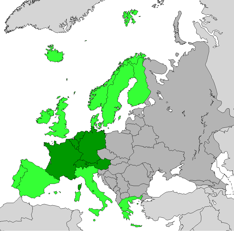
Español: Mapa de Europa Occidental de acuerdo con el Geosquema de las Naciones Unidas en verde oscuro. Europa Occidental según el concepto tradicional que se oponía al bloque de Europa del Este en ambos tonos de verde.
English: Map of Western Europe according to unstats.un.org in dark green. Maximun extent of Western Europe in green. |
| Date | |
| Source | Own work |
| Author | Maulucioni |
Licensing[edit]
I, the copyright holder of this work, hereby publish it under the following license:
This file is licensed under the Creative Commons Attribution-Share Alike 4.0 International license.
- You are free:
- to share – to copy, distribute and transmit the work
- to remix – to adapt the work
- Under the following conditions:
- attribution – You must give appropriate credit, provide a link to the license, and indicate if changes were made. You may do so in any reasonable manner, but not in any way that suggests the licensor endorses you or your use.
- share alike – If you remix, transform, or build upon the material, you must distribute your contributions under the same or compatible license as the original.
File history
Click on a date/time to view the file as it appeared at that time.
| Date/Time | Thumbnail | Dimensions | User | Comment | |
|---|---|---|---|---|---|
| current | 05:08, 12 January 2021 | | 922 × 908 (53 KB) | Maulucioni (talk | contribs) | Uploaded own work with UploadWizard |
You cannot overwrite this file.
File usage on Commons
The following 5 pages use this file:
File usage on other wikis
The following other wikis use this file:
- Usage on ar.wikipedia.org
- Usage on ast.wikipedia.org
- Usage on ca.wikipedia.org
- Usage on diq.wikipedia.org
- Usage on eo.wikipedia.org
- Usage on eo.wikinews.org
- Usage on es.wikipedia.org
- Usage on ext.wikipedia.org
- Usage on fr.wikinews.org
- Usage on ga.wikipedia.org
- Usage on gn.wikipedia.org
- Usage on ia.wikipedia.org
- Usage on it.wikivoyage.org
- Usage on kab.wikipedia.org
- Usage on tt.wikipedia.org
- Usage on vec.wikipedia.org
- Usage on www.wikidata.org